HOMEWORK: A06- Chapter 5 of Atlas for a
OVERVIEW and INSTRUCTIONS
GEOGRAPHY of
Purpose of the
homework assignment:
Apply concepts of geography to
DRAINAGE BASIN – the region ‘drained’ by a river, meaning, the area that sends water to a river. Watersheds are similar, but generally are portions of drainage basins.
Assessment: This assignment will be graded:
25% on supporting files.
At least five maps, charts,
schematics that show the web of relationships among the hydrosphere of “your”
setting, its peoples (such as water usage, and the environment.Your source for maps and charts can be from the county’s history,
or, most likely from the planning document of
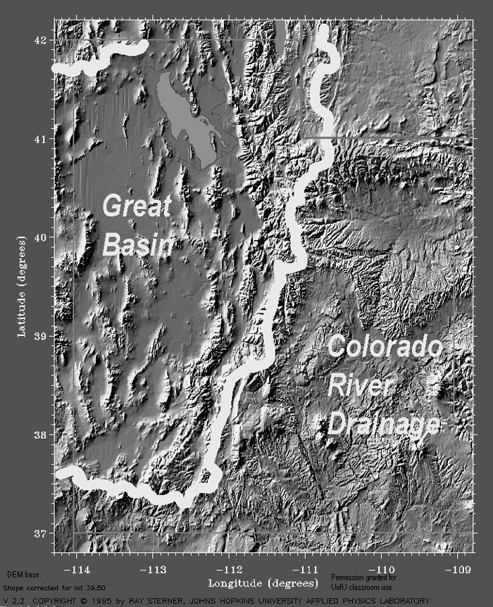
Also include these four files... in addition to those above... : Utah's major hydrologic basins on DEM Sterner base. and Major surface waters of Utah, on Miller base; and Major Watersheds of the USA from National Atlas; and, finally, USGS version of Water Cycle.
75% on cover page discussion…
(a) Observations: write at least 5 characteristics of the hydrologic (hydrosphere) setting of “your” community as shown in your supporting files (maps, figures, tables, …).
NOTE: the easiest way to do this is to list your figures on your cover sheet, meaning list the maps, charts, tables, images, AND write a caption for each of figures. If the caption reads: “note the lack of precipitation…” or “Figure ___ shows precipitation for the ___ basin is highly variable”… then you’ve made an observation. Don’t hesitate to state the obvious.
(b) Analysis: define and discuss at least 4 of the following water concepts in the context of “your” community’s water plan: water cycle, precipitation, surface water, ground water, water rights, waste water, water usage, and water rights.
(c) Interpretation: Recognize and describe three big issues that face “your” community with respect to the hydrosphere (interaction of physical and human geographies).
Your region’s water plan can be the basis for this assignment (source of figures --- reference the source; source of some definitions; source of issues).