HOMEWORK: A04- Chapter 4 of Atlas for a
OVERVIEW and INSTRUCTIONS
GEOGRAPHY of UTAH – Homework due Thursday, February 11… note… that may be the day we walk the Wasatch fault so don’t be late.
Purpose of the
homework assignment:
Apply concepts of geography to
PHYSIOGRAPHIC PROVINCE: a region based on landforms.
LANDMARKS: recognizable places that help orient and contribute to a sense of place.
Assessment: This assignment will be graded:
25% on your map files.
75% on cover page discussion…
(a) Observations of geographic characteristics of your area’s geosphere;
(b) Analysis and discussion of
those patterns with respect to
(c) Recognition and description of three possible landmarks for your school.
Instructions:
ADD THE FOLLOWING FILES TO YOUR ATLAS FOR SCHOOL PROJECT.
LINK to Guide for Contents of your atlas… updated for this assignment. You can add more files, but, at minimum four files (one cover page and three .jpg files of maps).
A04a-CoverPage-Topog-Landmarks
Cover page for Chapter 4: Topography, Landmarks, and Geosphere of _______
Observations concerning the topography of your school’s vicinity, city, and / or county.
Analysis of those observations using geographic concepts.
Write a minimum of 3 observations and a maximum of 8.
Think about what we’ve covered in class and what you’re expected to have learned.
Analyze the patterns or the topographic relationships you observed. Discuss its importance..
Discuss landmarks for your school.
Coaching: great geographers not only see what’s there… but what’s missing.
Keep asking yourself “why” …
The 5 why’s of
You may want to review the class session notes for the geographic theme of GEOSPHERE on both Tuesday and Thursday..
How much does the geosphere matter to your county? How does
your county’s geosphere typify one of the physiographic provinces of
Landmarks are one of the ways many people develop a sense of place. What makes a good landmark for a place (remember “place” implies connection… often an emotional connection, or historical, or recreational, or … )
Map – images files:
File #2
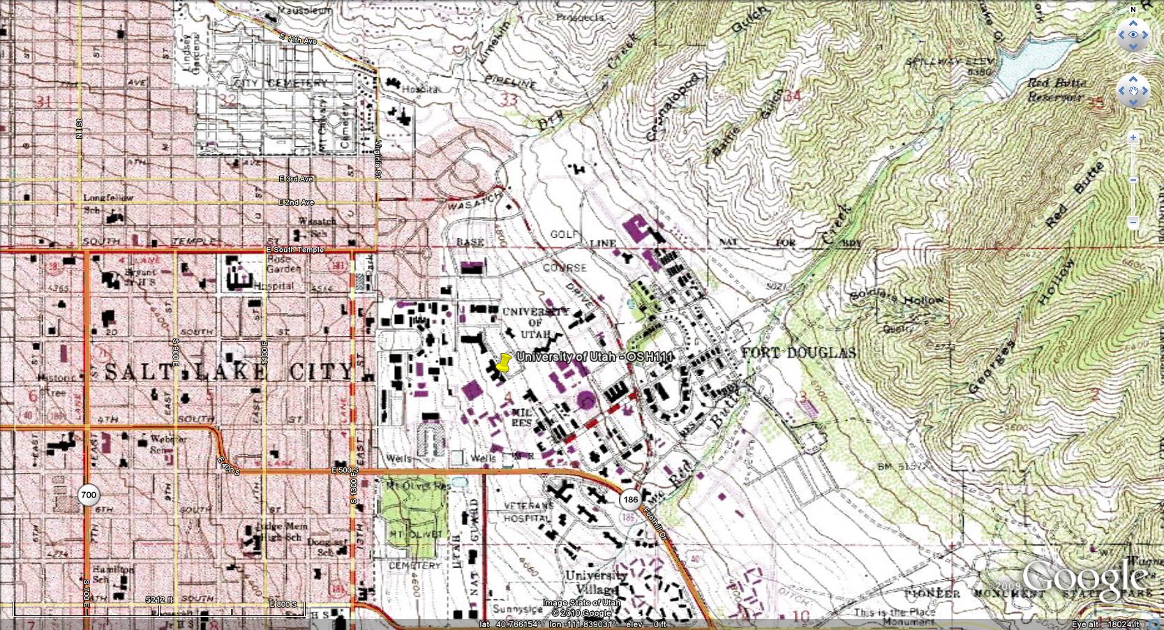
A04b-01-Topography.jpg
Several approaches…
1) Via Google Earth… I followed instructions on
http://www.kk.org/cooltools/archives/002970.php
And downloaded three jpg at different scales showing topographic contours.
It was remarkably easy.
Examples:
UofU-A04-b01-TopoMap-SLCoVicinty.jpg
2) Google Earth and Google Maps
Easy to see the terrain… difficult to download as a jpg.
a) locate the county in Google Earth. Shift to Google Maps.
b) make into a jpg with difficulty (print screen; paint; copy, paste; save as jpg)
3) via the USGS topographic maps site – :
http://nationalatlas.gov/natlas/Natlasstart.asp
a) this is an essential step find the FIND tab (upper left tab)
b) Type your city or county name in FEATURE
c) Then “show topographic map”
d) … mine looked kind of ugly until it was at detailed scale
e) download as a .jpg.
File #3
A04c-01 Image of your
county, your city, your region from Bowen
He has given
permission to use his images for educational purposes.
http://130.166.124.2/utah_panorama_atlas/index.html
Example:
UofU-A04-c01-Bowen-SLCoN.jpg
File #4
Image or map of Landmarks
Example:
UofU-A04-d01-UMountain
Example:
UofU-A04-d02-MtOlympus
Example:
UofU-A04-d03-FarnsworthPeak
Example:
UofU-A04-d04-GreatSaltLake
File #5
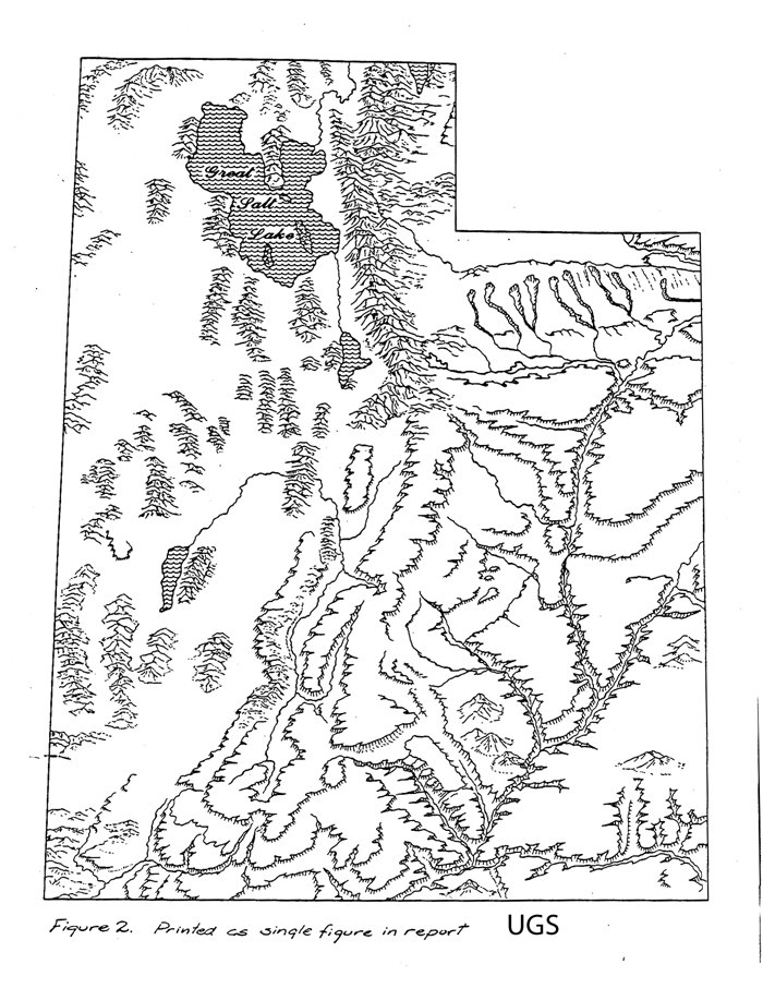
A04e-01-Ridd-LandformMapOfUtah
This is a straight
download from the course website.
And / or this schematic from Utah Geological Survey
File #7
A04f-01-Sterner-DEM-UtahPhysiogrProv
This is a straight download from the course website.
And / or the original data base from Sterner, Fermi Lab.
Sterner-DEM-UT-Landforms , Used with permission .
Additional maps as
you desire.
For example, you may
want two images from Bowen: A04c-01 and A04c-02
FILE STRUCTURE:
Please put all of Assignment 04 in a separate folder of your Atlas Directory…
otherwise I may not recognize what’s new and what’s old. I like the structure
of the Guide to Contents page, but it’s Okay to have a different structure so
long as each assignment is in its own folder.