COASTAL PROCESSES and Urban Environmental Geography
Genevieve Atwood, Ph.D., guest lecturer
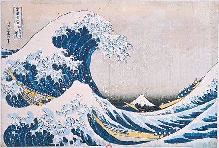
LINK to EncyBritannica-BreakingWaveOffKanagawa - Hokusai
THE OVERARCHING GOAL OF THIS CLASS SESSION IS: –
LANDFORMS affect Urban Environmental Geography
and COASTAL PROCESSES and LANDFORMS past and present affect global and local urban environmental geography.
GTHE PLAN - Lecture 20 min --- then we'll go outside for the rest of the hour and (a) observe; (b) discuss evidence; (c) tie to urban environmental geography.
THIS lecture assumes you already know about:
·
The Hydrologic Cycle (a.k.a. the water cycle). LINK to USGS
schematic
·
The Rock Cycle – includes how sediments are products
of sedimentation specifically… weathering, erosion, transport, and deposition LINK to ESE
rock cycle animation
By the end of this session, you should:
·
Understand what coastal processes are … (narrow definition
and broad definition)
·
Begin to understand the variability of coastal processes … huge subject
·
Know where and how to look for shoreline evidence in
·
Appreciate the hazard / risk globally .
So What? Global populace at risk for the United States... coastal counties are 17% of US counties.. with... 53% of population.
Why do people live along shorelines? Would you?
TERMS... .
Narrow definition: shoreline is the intersection of two
surfaces: (a) the surface of the water body, and (b) the surface of the land.
From Merriam-Webster on-line:
1: the line
where a body of water and the shore meet
2: the
strip of land along the shoreline
From Glossary of Geology, 5th ed., AGI iPhone ap
(American Geological Institute):
(a) The intersection of a specified plane of water
with the shore or beach; it migrates with changes of the tide or of the water
level. The term is frequently used in the sense of “high-water shoreline” or
the intersection of the plane of mean high water with the shore or beach, or
the landward limit of the intermittently exposed shore. … (Synonyms…)
(b) The general configuration or outline of the shore.
The terms “shoreline” and “coastline” are often used synonymously, but there is
a tendency to regard “coastline” as a limit fixed in position for a relatively
long time and “shoreline” as a limit constantly moving across the beach.
FIRST shorelines are associated with relatively large
water bodies.
To have a water body… necessary factors… must have a
place for water to be… and must have water.
Oceans - yes; Lakes - yes; … Ponds?
Global scene – Oceans (LINK to Norton-15.03 Global Coastlines;
and LINK to Norton-15.03abc added relief and tectonics)
For purposes of this talk… NOT going to explore how
the water body got there… and not how that-which-contains-the-water got there... there are several possible ways… tectonics, dams…
can’t go there today… but never forget tectonics.
BROADER DEFINITION
and how we talk about
"shorelines" here
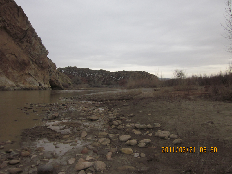
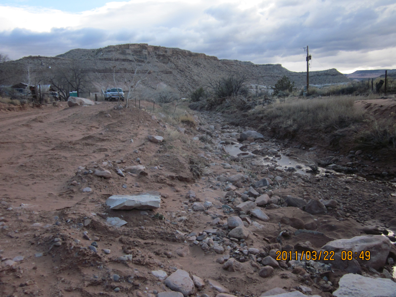
Evidence… what might it be? (a) topographic
expression (shape, size, and slope); (b) materials; (c) all due to coastal
process (waves, currents, biota).
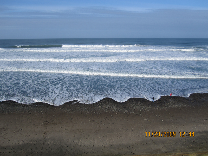
VIRTUAL TOUR of SHORELINES… Who has been to a great
shoreline… anywhere?
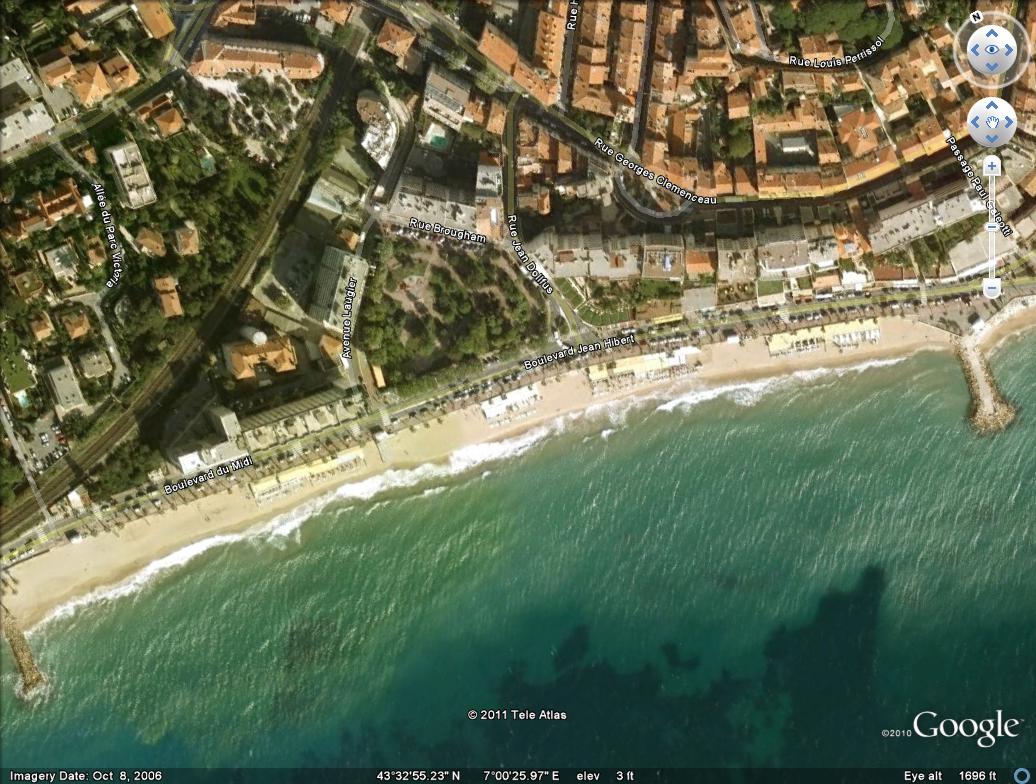
French
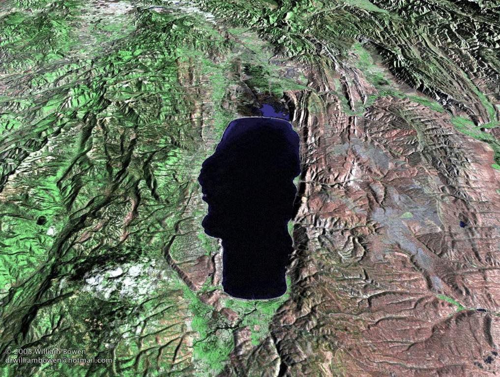
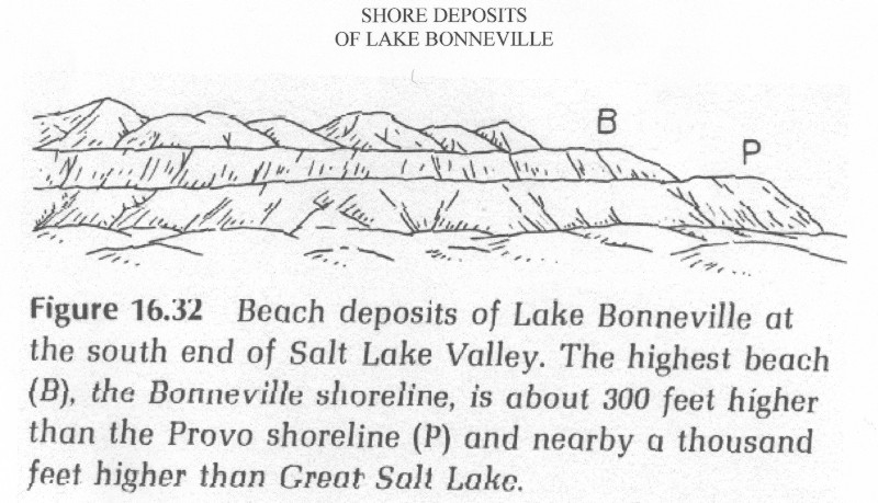
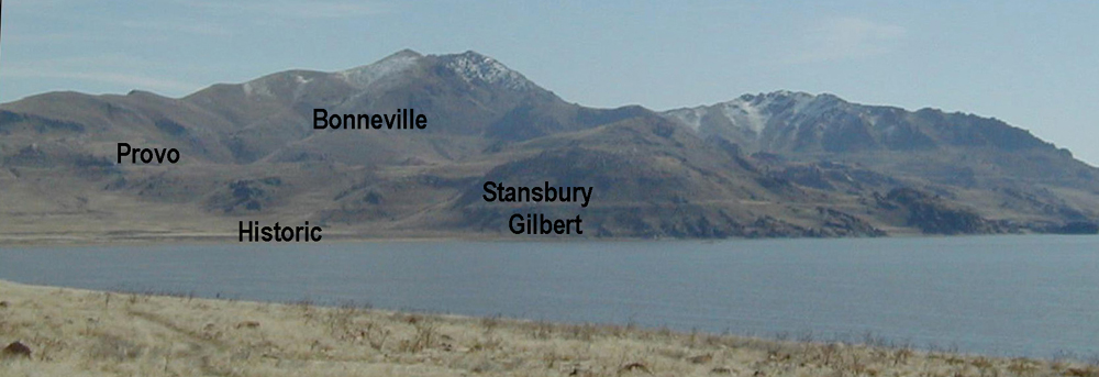
GREAT SALT LAKE Bowen image of lake; 1987 satellite image and 1960s photo composite; Water Balance
LAKE BONNEVILLE map 73 contrast... Evidence... COASTAL PROCESSES leave evidence
SHORELINES as landforms
LANDFORMS – are natural features on Earth’s surface with:
1. Characteristic
SHAPE
2. Characteristic
MATERIALS
3. Characteristic
PROCESSES that make them
And… all landforms have a history… they each tell a
story (just like every rock has a story)
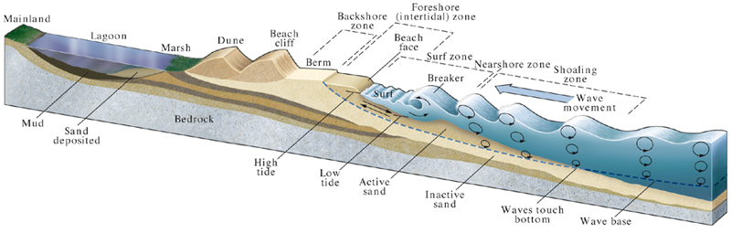
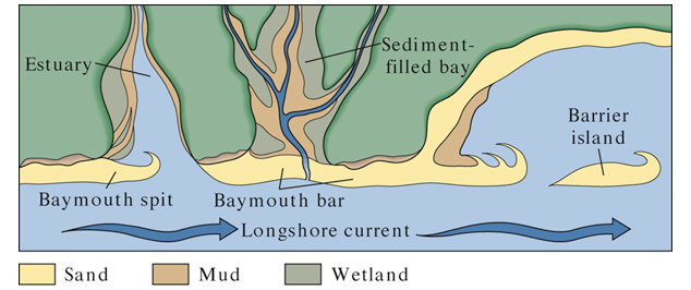
DIAGRAMS… for an ocean but similar processes
Cross-section of a depositional (accreting): LINK to
Norton-15.15
Plan-view of shorezone… not
And 3-D of up-welling and down-welling along shore: LINK to
Norton-15.10ab
Field Guide to Shorelines... what to look for
LINK to HUNT sketch of Bonneville Shoreline LINK to Hamblin image of Point of the Mountain.
SHAPE: Virtually horizontal.
MATERIALS: Sediments
NOT like a RIVER... NOT like a deposit from a flash flood
PROCESSES: Erosion / deposition.
WHAT TO LOOK FOR:
Scenery - yes
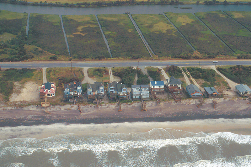
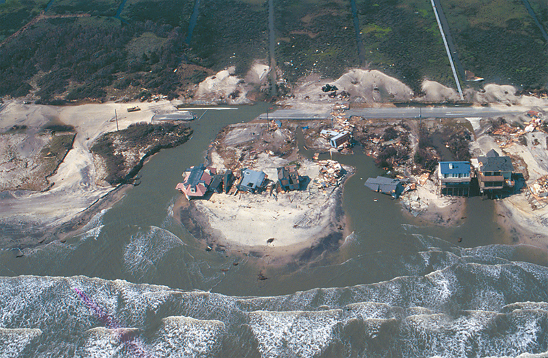
Hazards – yes
·
Norton15.35a; Norton15.35b; --
·
USGS links among others:
http://coastal.er.usgs.gov/hurricanes/katrina/photo-comparisons/dauphin.html
Resources – yes – particularly if one
counts recreation (beaches) and ecosystem.
·
SFBay, example: http://sfbay.wr.usgs.gov/general_factsheets/coastal_resources.html
Science – yes
·
Why? Interfaces interest scientists… where change
happens…
·
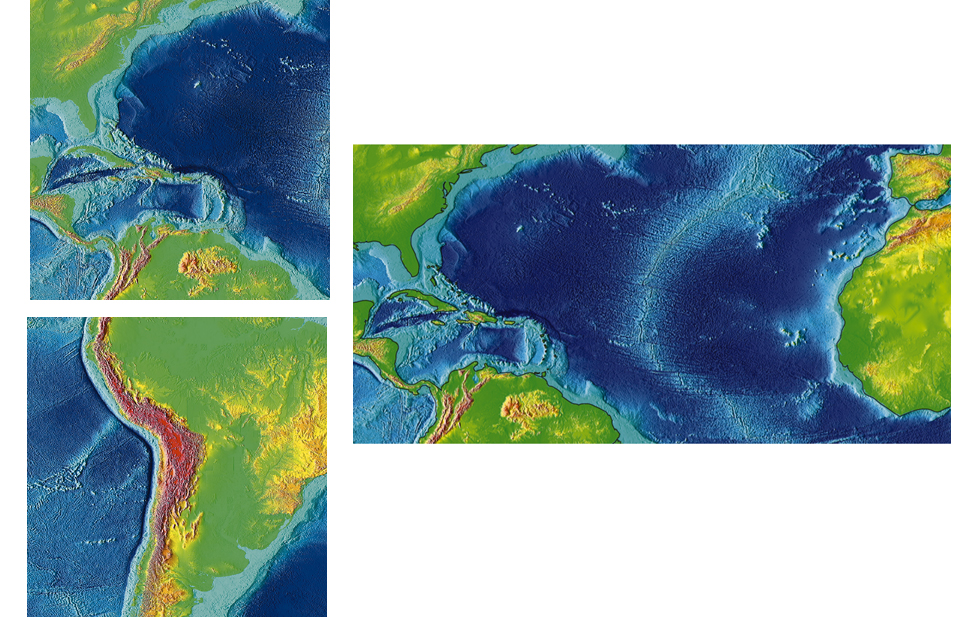
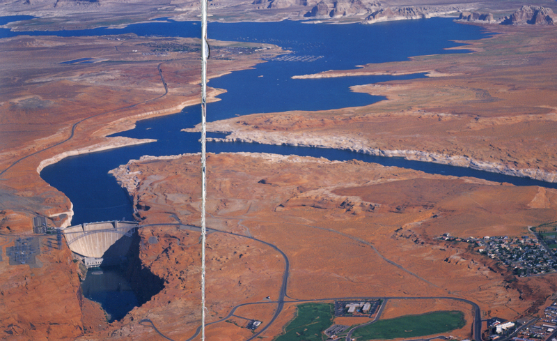
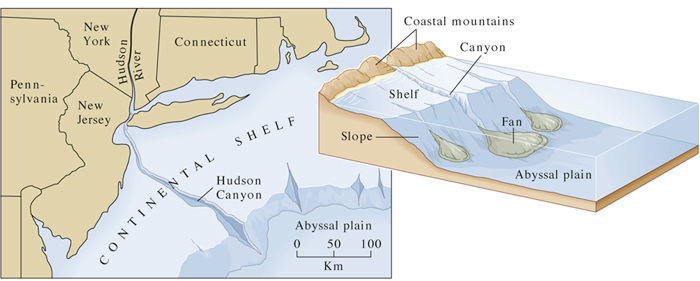
East coast, continental shelf – LINK to Norton-15.05 NewEngland
Importance of shorelines… locally…
Great
Salt Lake and
Scenery – yes – particularly if you
appreciate the subtlety of the Basin and Range. LINK to Hamblin
Hazards – several… of GSL and of
paleo-shorelines of
·
For example, this landslide in
·
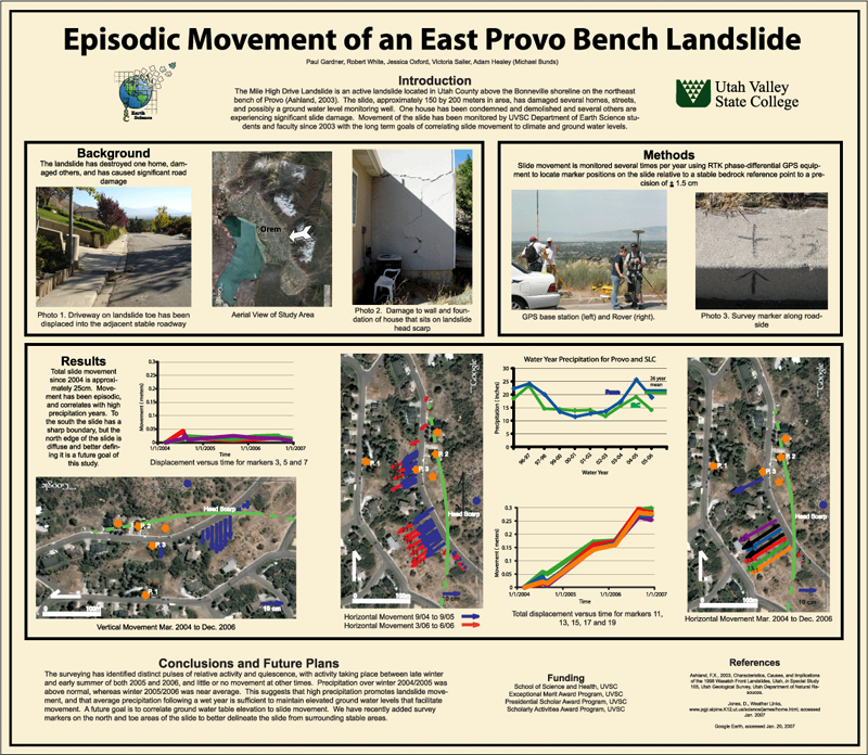
And... Sherwood Hills landslide studied by UVU undergrads
on topography steepened by Lake Bonneville shore processes LINK to UVU
undergrad poster by (Paul Gardner, Robert White, Jessica Oxford, Victoria Sailer, Adam Healey (Michael Bunds), 2008). The "bad-actor" bedrock is the direct cause of the ground failure, but the slope, oversteepened by Lake Bonneville coastal process probably contributes to instability.
Resources – important –
·
shoreline sand and gravel… for constructions LINK to
Hamblin Point of Mtn
·
benches for building sites, for example UofU, BYU,
WSU, parts of USU, on shoreline features of high levels of Lake Bonneville… and
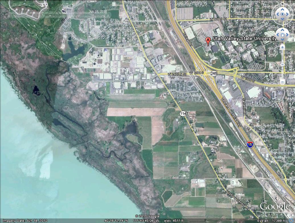
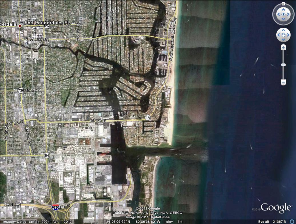
UVU, too, on delta deposits. LINK back to UVU image from GoogleEarth shown before... look at all the construction.
Science –
·
Great Salt Lake –
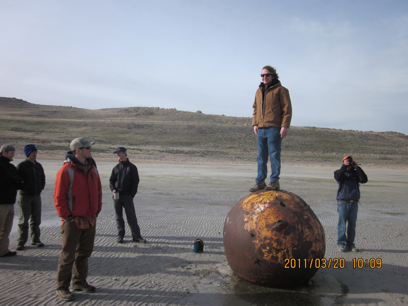
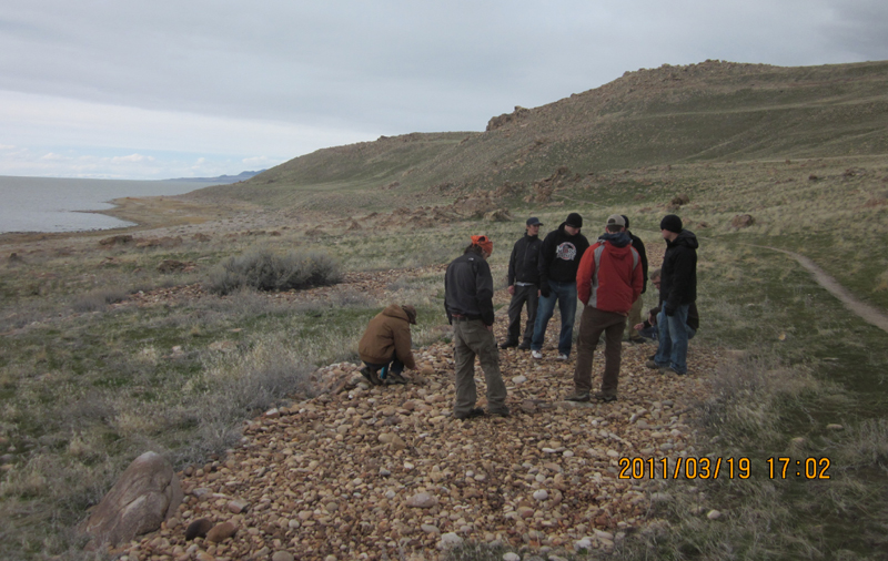
Let’s go "collect" some shorelines …
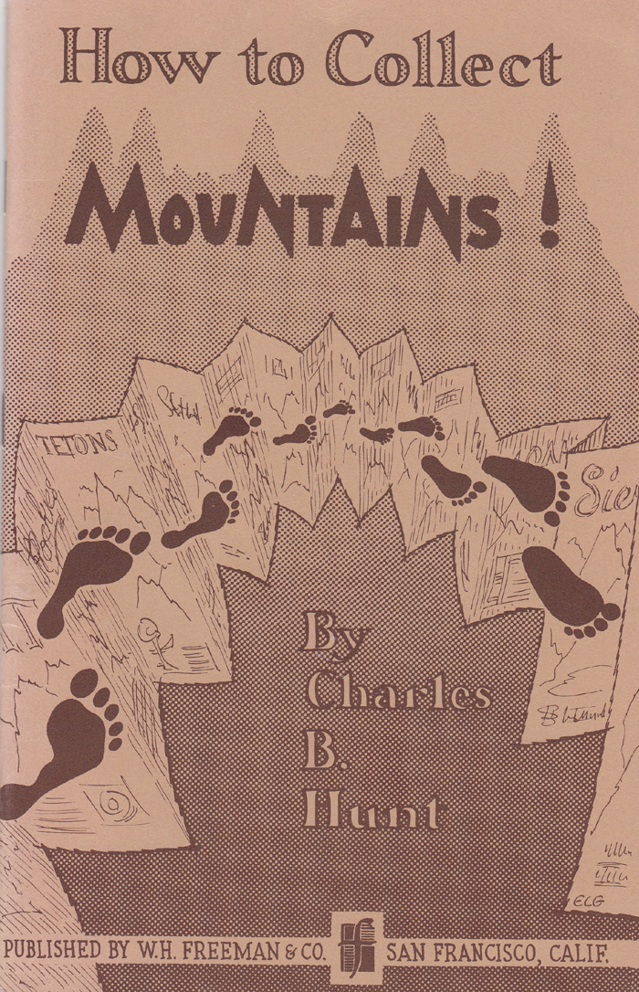
CB Hunt "collected" mountains... every kind he could find (LINK). Let's collect some shorelines, such as:
1.
Modern
shoreline of a fresh water, shallow lake … What is special about Utah Lake?
2. Shoreline
evidence of the past… Can you see through the haze, into the distance and recognize shorelines of Lake Bonneville on the west side of Utah Lake?
3. Active deltas of Utah Lake … may be impossible to see.
4. Deltas of
past… trick question unless you recognize the obvious.