Geography, Utah and Religion
First some terms and concepts
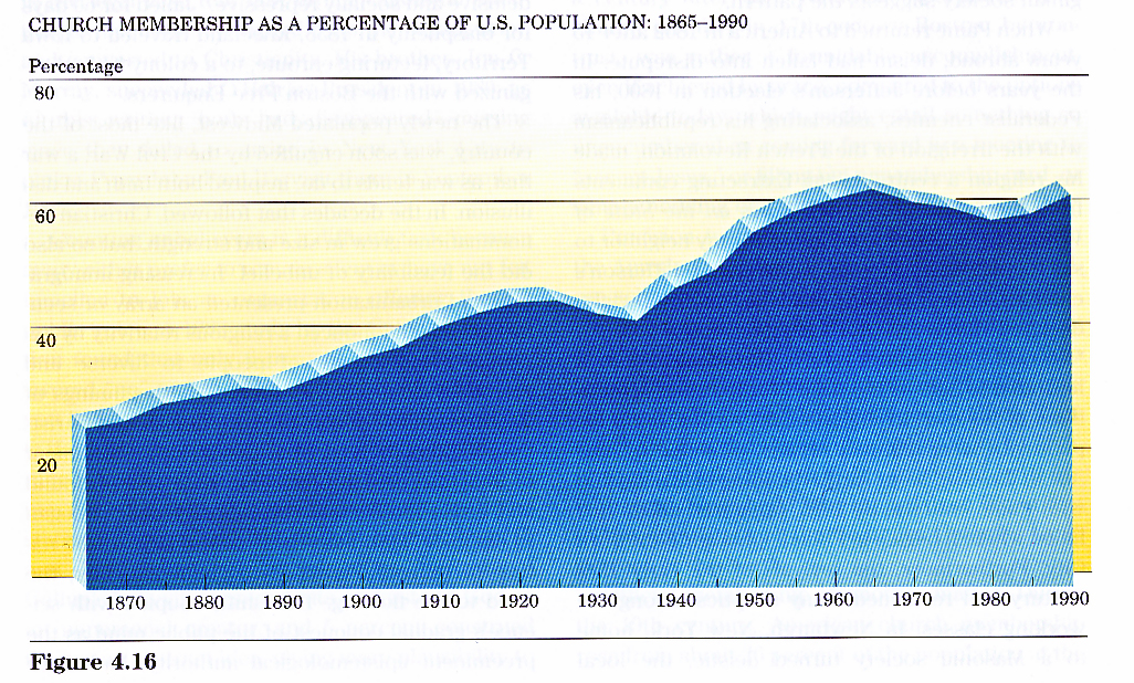
Second some national trends and contrasts and concepts
Third some geographic contrasts within Utah.
CONCEPTS
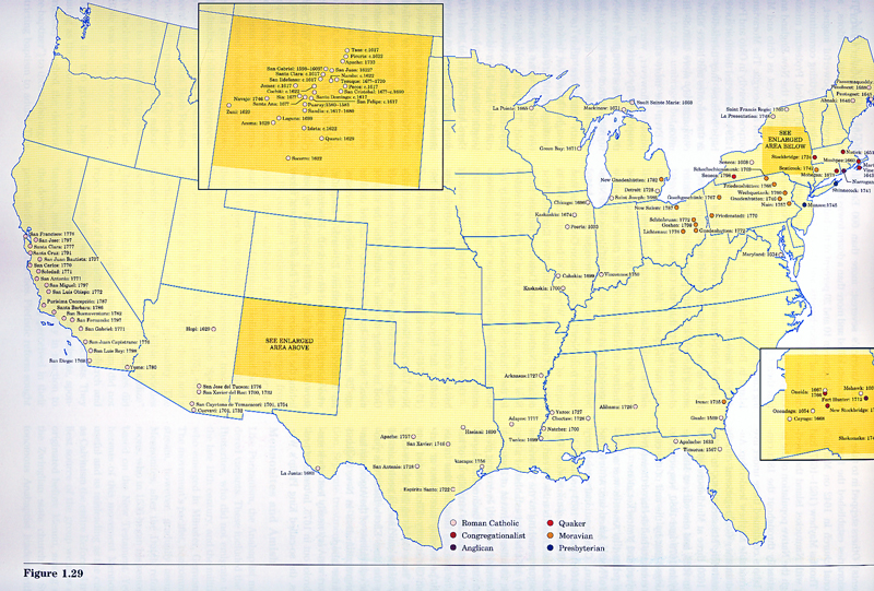
Native Americans -- Utah and religion before pioneer settlements G-B Missions
LDS to Utah ... geographic reasons ... Why Utah... think the subsystems of geography / earth systems
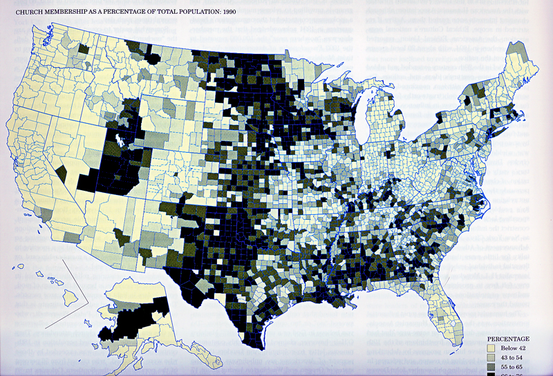
Utah a state with a high proportion of population with church affiliation
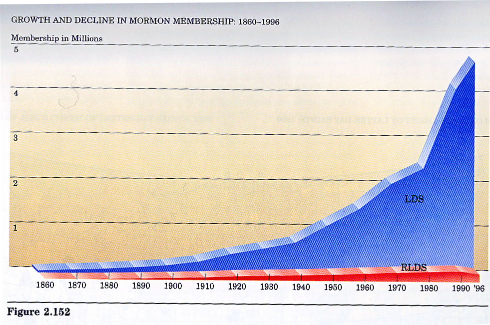
Utah is the center of the LDS church -- a world wide religion -- world view
"Mormon cultural region"G-Bxxx
time time time time time time
Within UTAH patterns of religions
Altas, Atlas, Atlas, Atlas Episc Masons
Why a "dangerous" subject for UofU discussion in class....
So...
Statement of potential biasses:
I am a 5th generation non-Mormon married to a 5th
generation Mormon-by-heritage and his children are active LDS. He is not but he
is on the LDS church records as LDS. My mother was Utah-Catholic. My father was
New England-Episcopalian. He converted to LDS in 1976 and died a true believer
sealed to my step mother’s LDS family, whom we love and respect. I grew up
Episcopalian, went the Presbeterian church for Brownie Scouts, the LDS ward for
Girl Scouts, and went to a Quaker college. I’m grateful for my heritage and
associations with LDS and non-LDS. I watch with interest discussions of
divides, but, frankly, I am intellectually more interested in shoreline of
Specific geographic
questions: What are the geographic patterns of religious affiliation in
Data needed: Religious
affiliation over time of Utahans by county and for the
BUT I know this information only partially exists… may only
exist in comparable statistics for LDS… and that is will have problems as data.
I know this in part because my own church acknowledges that it does not know
it’s membership except by proxy; and the
Data that I have:
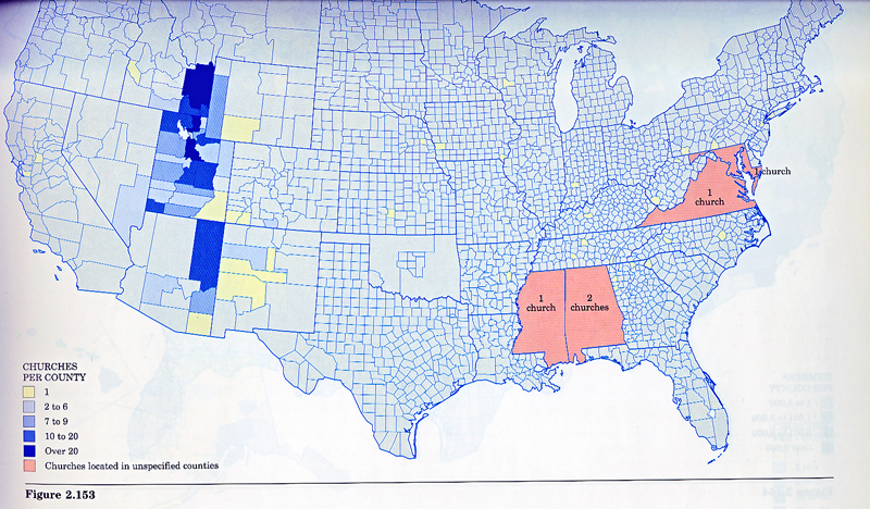
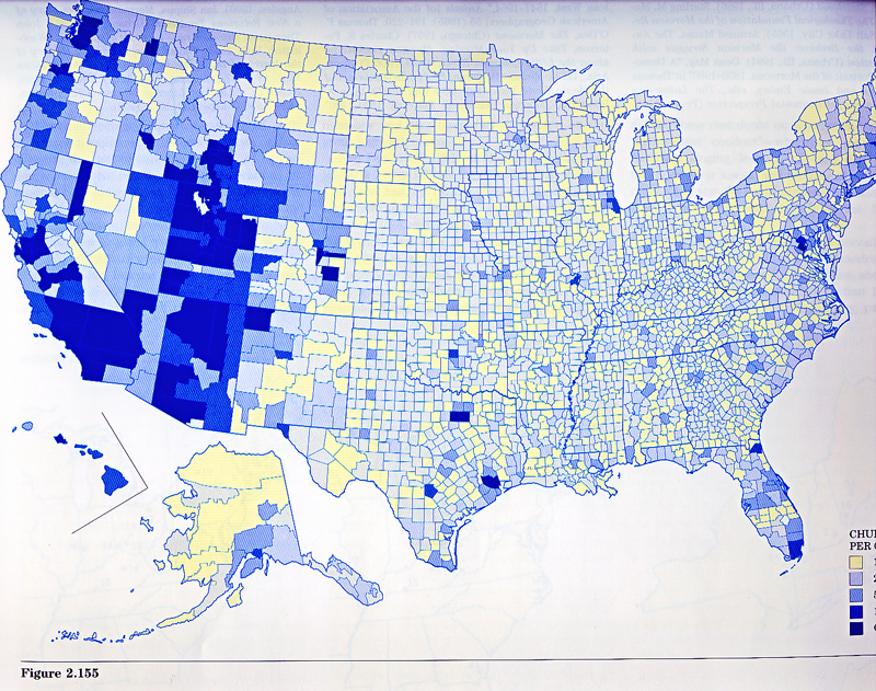
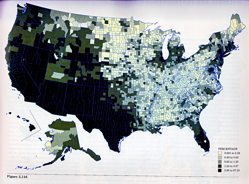
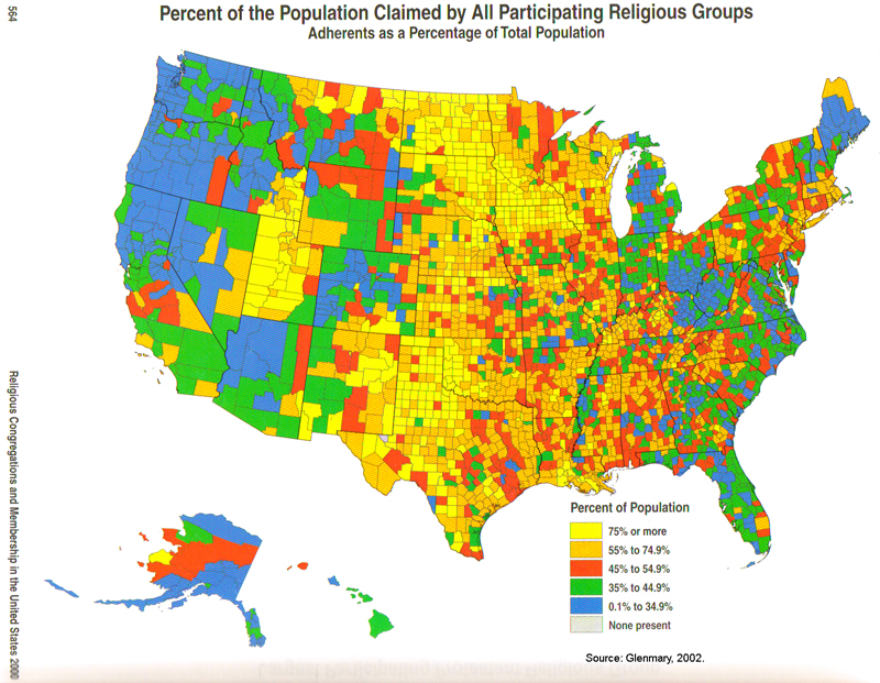
LINK Map of US showing percent of population considered as belonging to a religion in 2000
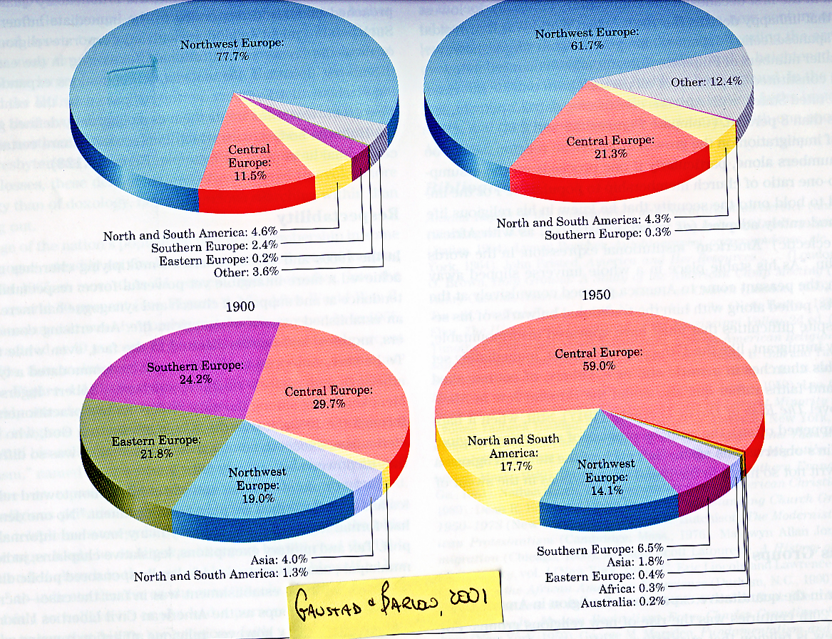
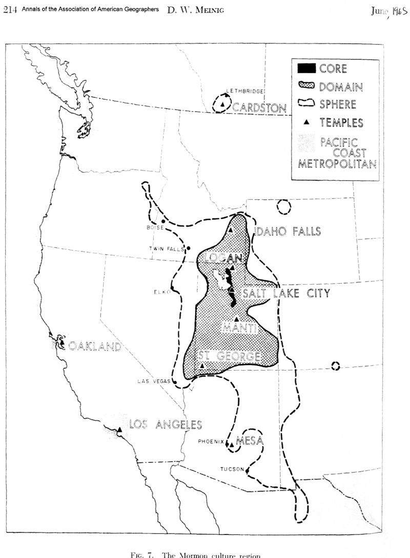
From D.W. Meinig.
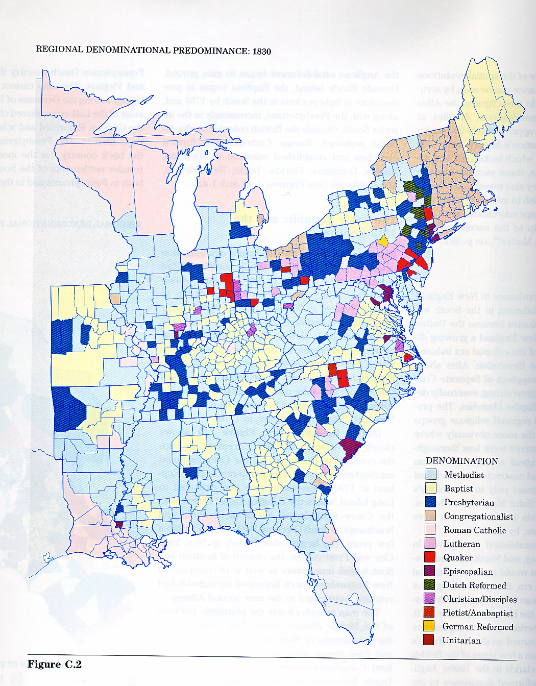
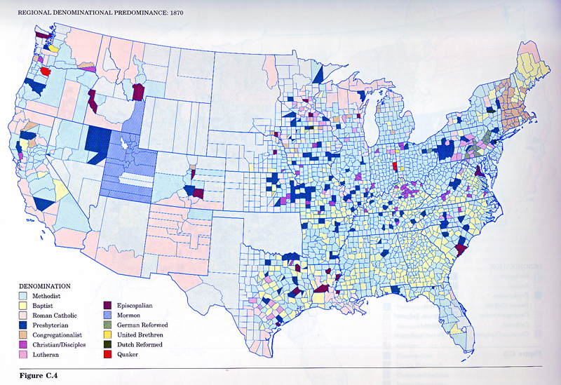
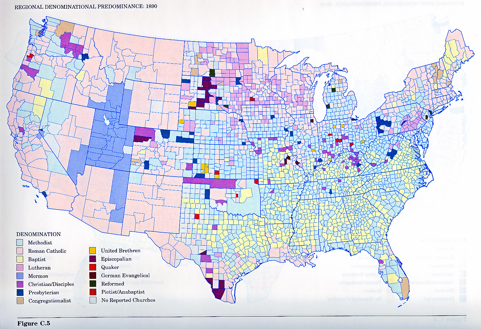
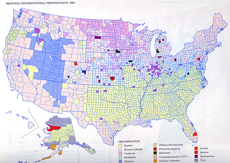
____, 1965, The Mormon Culture Region: strategies and patterns in the geography of the Mmerican West, 1847-1964; Annals of the Association of American Geographers 55, no 2, 191-220. p 196: The Mormon Region, counties by percentage; p 214 The Mormon Culture Region.
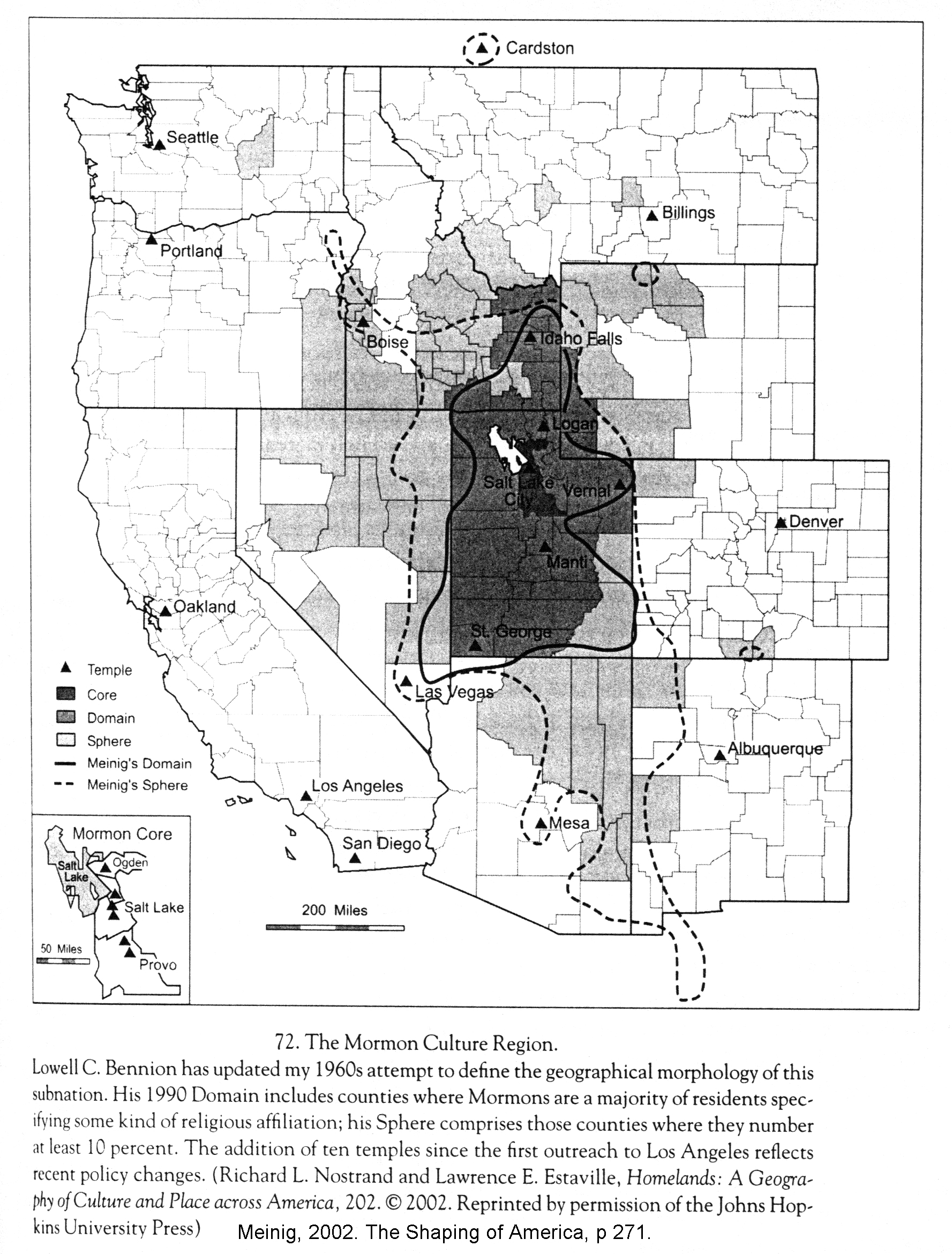
____, 2002. The Shaping of
From the Atlas of
Atlas page 142 Mormon Culture Region
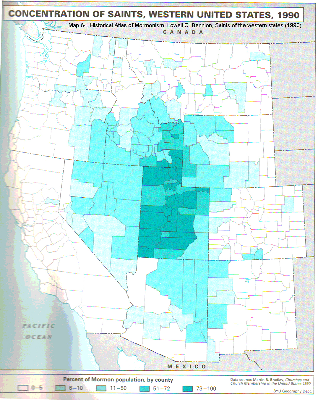
Atlas page 143 Mormon Church membership of western US by county
Atlas page 145 Legend to accompany maps Interpretation: of the people who consider themseleves ____, ___ % live in ___ County.
From Historical Atlas of Mormonism, 1994.
Saints of
the Western States (1990) by
From the Salt Lake Tribune archives for July 24-26, 2005
Matt Canham series on changing demographics LINK? LINK? Handout?
Maps… I could create.
Even though the data have shortcomings, I intend to create maps that display
the Glenmary data for
Findings:
Glenmary maps:
Observation:
Observation: No other state shows solid gray, solid and striped gray.
Observation: Neighboring states have sections of gray and striped gray and these change, but not dramatically over the 3 decades.
Observation: Other colors of other states change more than
For maps by county:
Hypothesis #1 and
Finding #1:
Hypotheses, analysis and discussion…
Geosphere
Hydrosphere
Atmosphere
Biosphere
Anthrosphere… correlation and causation…
History
Connectedness
Leadership
Demographics
Economics
IN CLASS EXERCISE -- NOTE IT IS ANONYMOUS - Sign the roster for full credit LINK and map and Bennion discussion
Summarize his hypotheses… your handout
NOTE!!! This hand out is anonymous, but just being here and handing it in you get full credit.
Conclusions: