Geology and Hydrology of
Genevieve Atwood, October 2007
Chief Education Officer, Earth Science Education
Adjunct,
To view this talk on the web, go to http://www.earthscienceeducation.org/ and follow the links.
The purpose of this talk is to give some perspective,
some rationale of why Salt Lake County’s watersheds are the way they are,
specifically why Great Salt Lake is located where it is; why the Jordan River
flows north; why some places are better than others for landfills; and how
climate has affected the region.
Here are three take-away messages about
·
Geology 101, Earth materials: The bedrock of
·
Geology 101, Landscapes: Tectonics sets the scene.
Erosion and deposition modify the scene. Extensional tectonics of the past 20
million years has caused
·
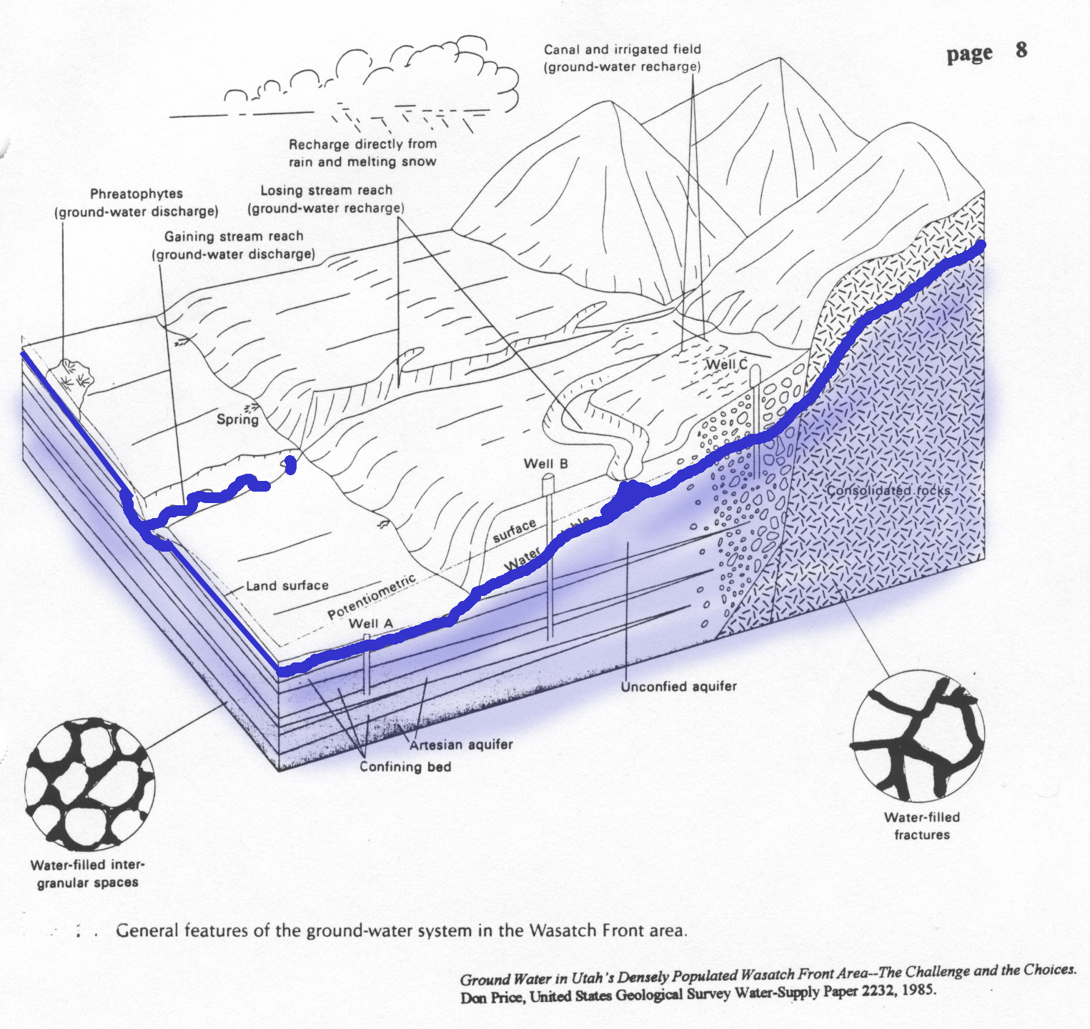
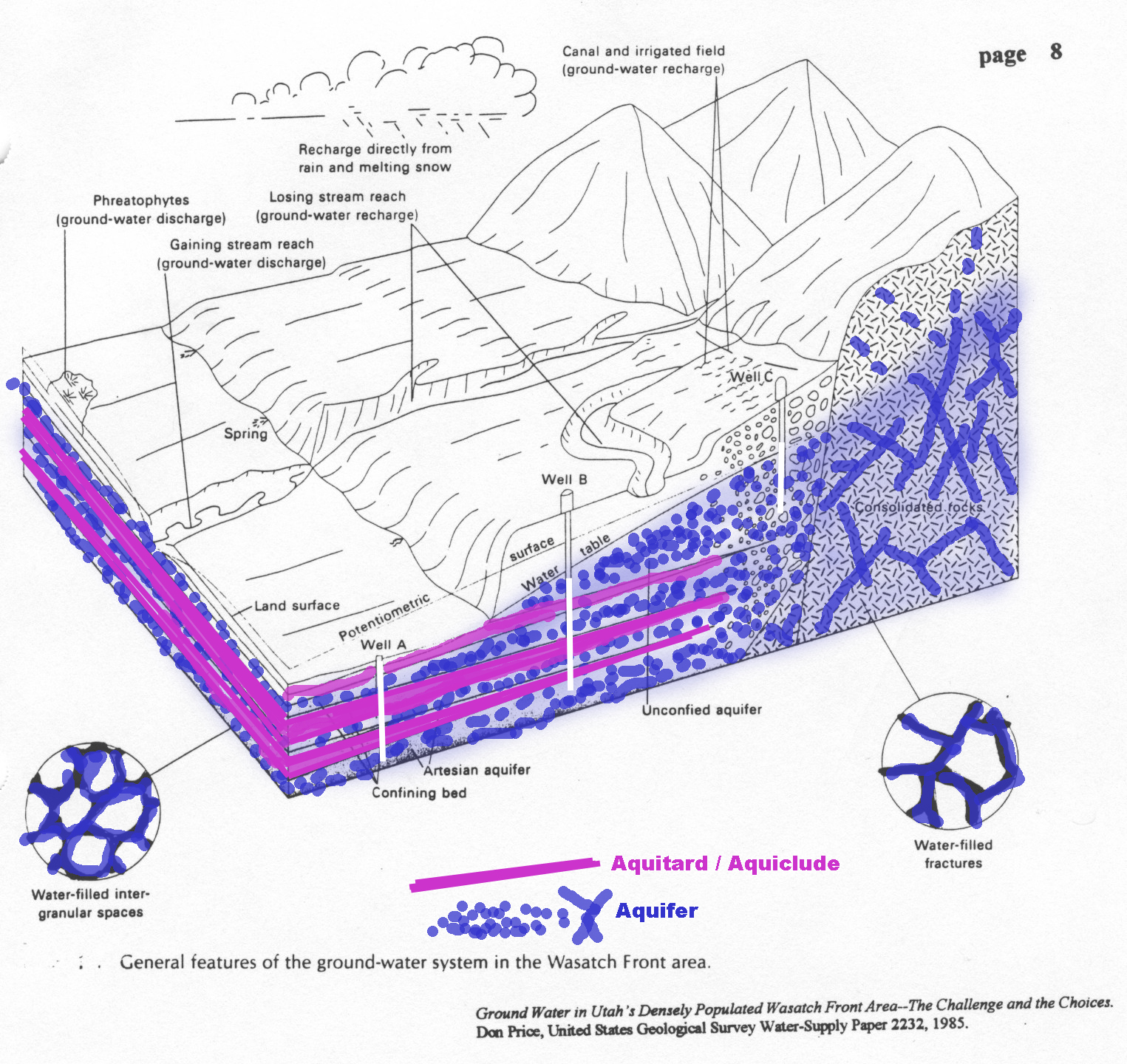
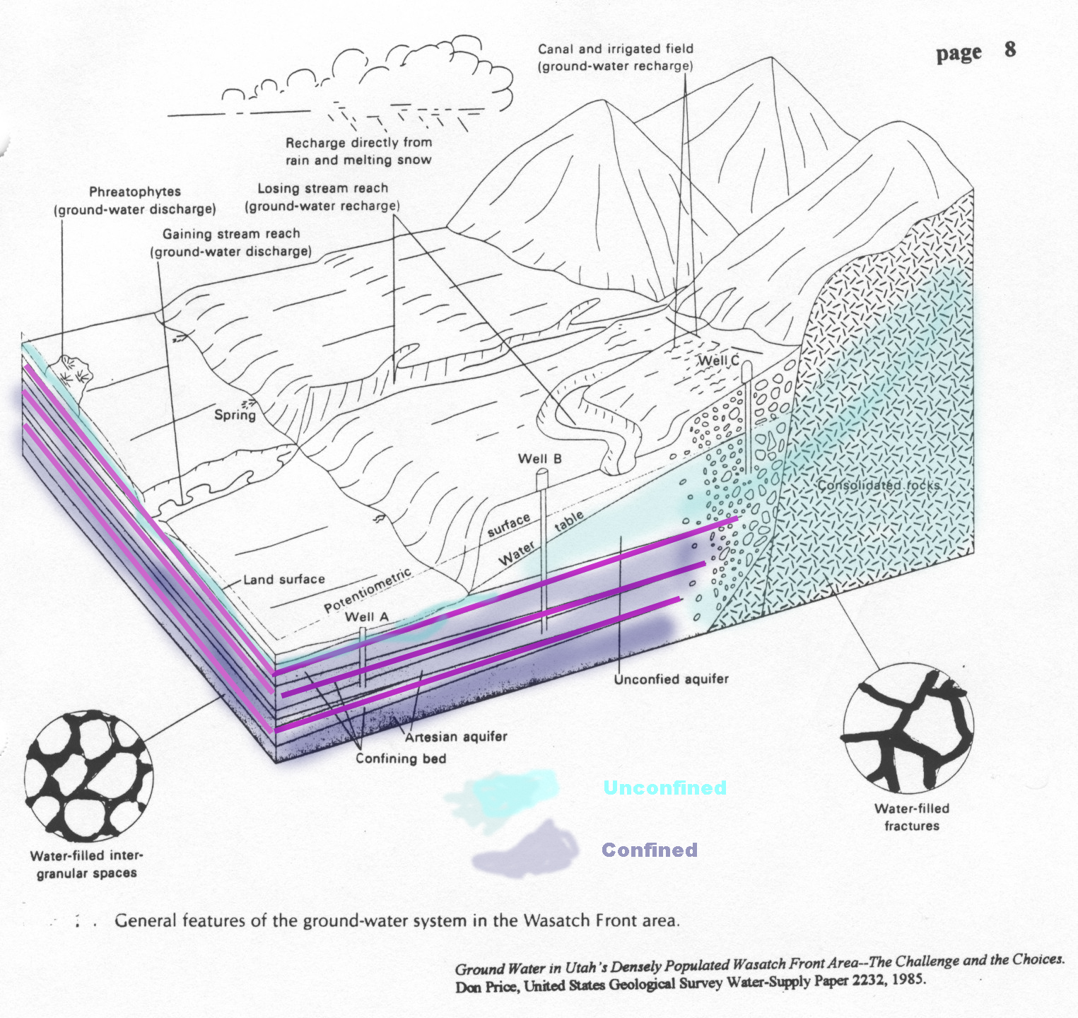
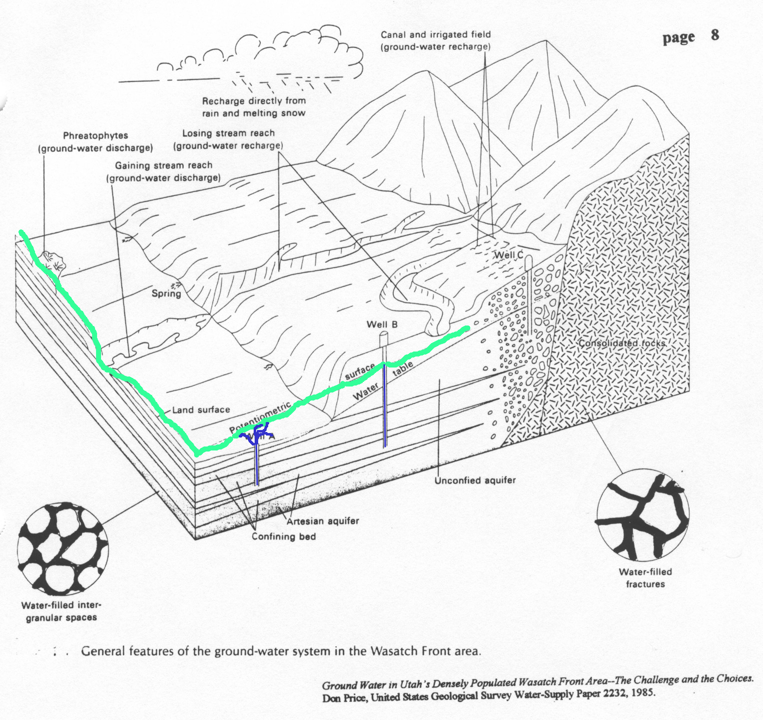
Hydrology 101: Ground water and surface what of
By the end of this talk, you should understand this
schematic of
FIRST – location, location, location.
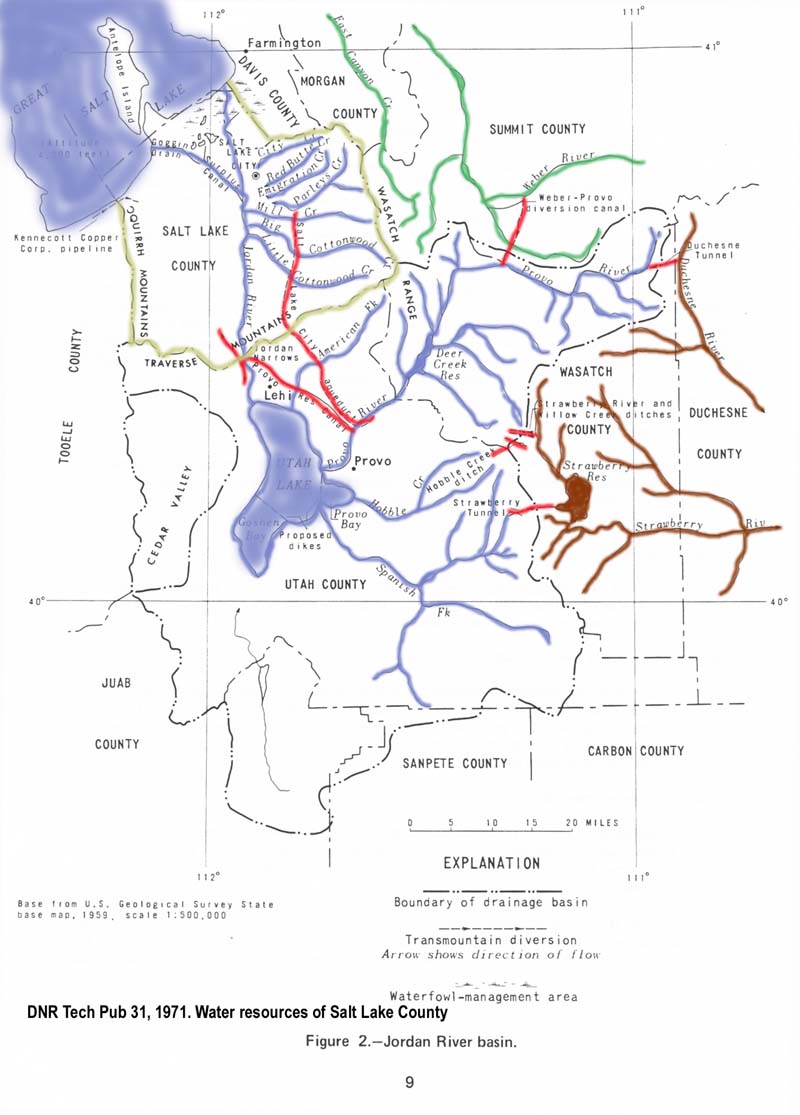
LINK to USGS Tech Pub 31 map of major drainages in
LINK to USGS Tech Pub 31 map of
LINK to PRWUA - JVWCD Map of watersheds of Salt Lake County
What this means to
With respect to watersheds:
·
·
Colorado Plateau = rivers run through it;
·
Basin and Range = rivers run to it.
http://130.166.124.2/utah_panorama_atlas/page20/files/page20-1021-full.html
used with permission William Bowen, 2006. SLCo-page20-1021
Rocky Mountain region = high terrain
with massive complexes of mountains and ranges above 9,000 ft a.s.l.; humid
continental – hot summer climate, more precipitation than evaporation; snow in
winter; recharge from snow melt; vegetated valleys and parks; extensive
watershed catchment areas; major recharge areas for
Salt Lake Valley aquifers; major sources of ground and surface water for Salt
Lake County communities; water quality – naturally good quality although
affected by geology, issues of mining, non-point sources, and point sources; evidence
of both erosion and deposition processes; issues of climate change.
Basin and Range physiographic province
Bounded by Wasatch fault on the east; broad
basins and narrow, north-south trending mountain ranges; arid to semi-arid
climate; climate zone = steppe (less precipitation than evaporation); limited
precipitation; ephemeral drainages from ranges, winter snow with some recharge;
thunderstorms cause rapid runoff and debris flows; limited as ground water
sources for Salt Lake County (Magna, Herriman?,
Kennecott properties?); water quality issues affected by geology, residence
time, mining; erosion in ranges but region dominated by deposition in broad;
closed basins, issues of climate change.
LINK – UGS(Stantec) geologic units of SLCounty
– affects water quality and water flow
LINK – USGS – Bedrock versus basin fill –
affects groun water quality (somewhat) and water flow
(hugely) LINK ESE schematic cross-section
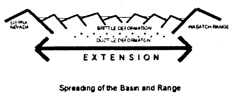
SECOND – Tectonics and landforms
Why are there contrasting physiographic provinces? Different geologic histories.
Far western
LINK to schematic of extension of Basin and Range
Basin and Range physiographic province = extensional
tectonics.
THIRD – Climate change
Given that tectonics results in closed-basins, we get
lakes. Closed basin lakes are historians of climate change. As colder, wetter,
cloudier climate drives the lake upward (1) wave processes create shoreline
expressions, and (2) rivers carry sediments and dissolved constituents into the
lake and they are deposited as layers across the lake bed. Note: these layers
are important to
LINK Great Salt Lake –
LINK to USGS Tech Pub 31 – SLCounty
precipitation
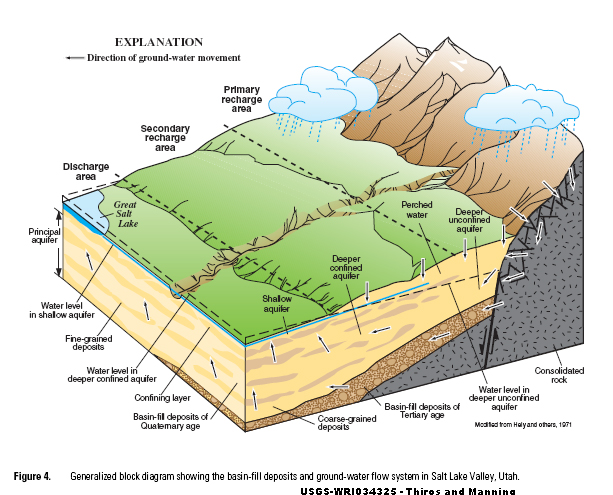
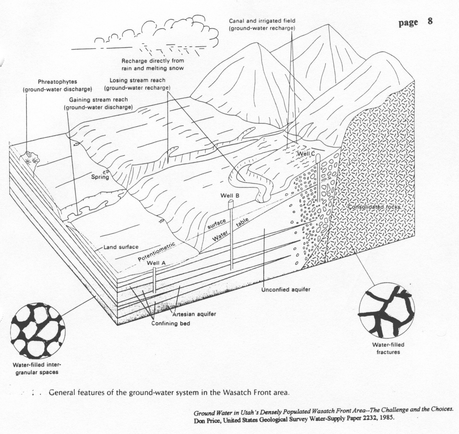
FOURTH – ground and surface water hydrology
of SLCounty.
Analysis of the Arnow, 1983
(USGS Tech Pub 31) – Thiros, 2003 (USGS WRI-034325) schematics
LINK to schematic in color (Thiros,
2003)
LINK to schematic in black and white (Arnow, 1983)
LINK to confined versus unconfined aquifers
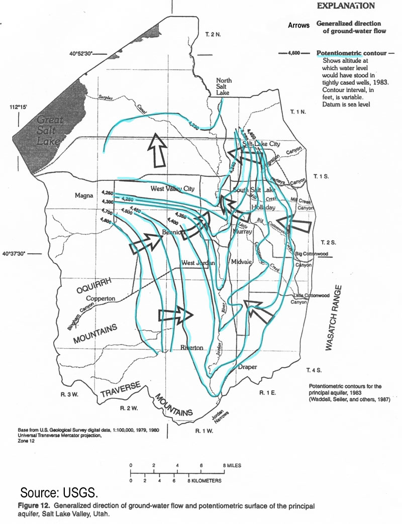
LINK to potentiometric surface
LINK to plan view of groundwater flows
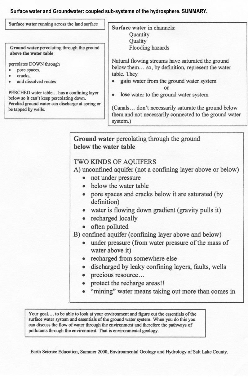
LINK to summary of ground water and surface water
relationships