Earth Science Outside – Warm Springs Park – SLCounty – Salt Lake School District
PURPOSE of this web page: Self-guided field experience specifically for 2018-2019 participants in Earth Science Outside USBE workshop.
CONTENTS: Location map(s); Advice; Ties to K-12 science framework; Physical geography; Suggested activities; Connect to core ideas Earth science; Questions to wonder about; Geologic history of the park and Salt Lake Salient; Resource materials; Acknowledgements; How to cite this webpage.
This website changes monthly. Consider its content DRAFT. Don’t hesitate to suggest improvements. We develop it for Utah teachers who want to go outside and share the JOY of observing the Earth science that surrounds us. We plan a glossary for technical references. Several sources of information are listed as RESOURCES.

LOCATION:
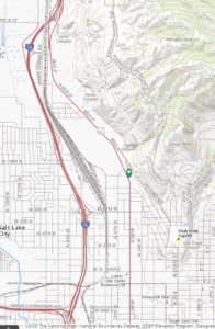
For your GPS unit: Enter the address of the Tesoro gas station, 965 Beck Street, 84103, opposite the park. The site is known by diverse names including: North Gateway Park, Warm Springs Park, former Wasatch Plunge, and former Childrens Museum.
ADVICE:
Visit this site in daylight and with a buddy so you can concentrate on Earth science. The warm springs have attracted residents, visitors, and transients for hundreds if not thousands of years. Imagine these springs from perspectives of Utah’s early peoples, European explorers, LDS pioneer settlers, bathers a century ago, and neighbors today. Do not be surprised by homeless camps in the vicinity. You are more likely to run into an elderly couple coming to bathe in healing waters than into criminal activity. Even so, lock your vehicle, and consider parking along the north margin of the parking area, easily visible from the sidewalk loop and from the highway.
Hazards are minimal. At the gray-boulder retaining wall, be alert to the unraveling slope behind (east) of the wall and instability of the boulders. Along the sidewalk south of the springs, walk carefully across the slime-covered sidewalk due to drainage from the springs. As an urban park, the site can have of trash. Salt Lake City maintains the park to be safe and neighborhood-friendly.
TIES to K-12 Science Framework.
Earth Materials (bedrock, sediment, rock cycle)
Plate Tectonics (past and present)
The Roles of Water in Earth’s Surface Processes
The History of Planet Earth
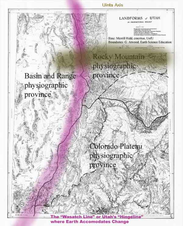
Change happens here!
Look westward at patterns of basins and ranges. Great Salt Lake occupies the lowest basins of the Bonneville Basin. The Oquirrh Mountains and Antelope Island are ranges of the Basin and Range Physiographic Province. Look eastward at the Wasatch Front, the bold set of mountain faces of the western margin of the Rocky Mountain Physiographic Province. Look north at the Salt Lake Salient that separates Salt Lake City from Bountiful. It is a feature of the Rocky Mountain Physiographic Province but does not resemble the bold mountains east of it.
Physical Geography
TODAY:
Utah has three regions defined by landforms: the Basin and Range Physiographic Province, the Rocky Mountain Physiographic Province and the Colorado Plateau Physiographic Province. Warm Springs Park and the Salt Lake Salient are on the boundary between the “Basin and Range” and “Rocky Mountain” province. The boundary is generally accepted as the Wasatch Fault Zone. Change happens here!
IMPRINT of the PAST:
The west – east contrast of Utah’s landforms is an old feature sometimes referred to as Utah’s Hingeline or the Wasatch Line. For example, millions of years ago during the time of trilobites, western Utah was dominated by marine (ocean) shallow seas and eastern Utah was dominated by low-lying land. During the age of dinosaurs, what is now western Utah was dominated by mountain ranges as impressive as the Andes, and eastern Utah had deltas and swamp along the margin of an inland sea. The imprint of these older chapters of Utah’s past can be recognized in the rock record at this site.
Less obvious is the imprint of the Uinta Axis, a very old feature of Utah’s crust that aligns with the Uinta Mountains of today, but has influenced the geologic history at this site.
Thus, this site is at the intersection of two sets of contrasting regions. No wonder it has perplexed Earth scientists from G.K. Gilbert to the present.
SUGGESTED ACTIVITIES along the WARM SPRINGS LOOP
GOALS of these activities:
Enjoy the challenge.
Recognize patterns of landforms, specifically changes in slopes.
Appreciate how sediments record environments of deposition and how sedimentary bedrock (once sediments) record environments of deposition of the past.
Distinguish tilted bedrock (layered gray rock) from overlying brown bedrock.
Recognize four or five clues to how this landscape came to be.
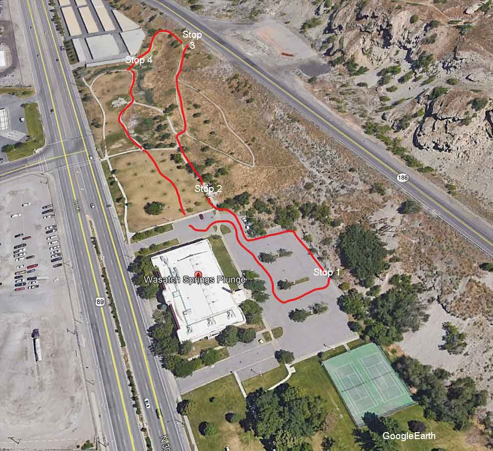
Stop 1:
Gray boulders of the retaining wall
Stop 2:
Cobbles (rounded, melon-size rocks) of the pillars by the rest room.
Stop 3:
Vista of bedrock exposed in the quarry: brown bedrock above; gray below.
Stop 4:
Warm springs of the park.
At each stop –
Fill out the hand-in sheet.
Observe patterns.
(a) patterns of Earth materials.
(b) patterns of landforms.
Express curiosity!
Take an image.
K-12 Science Framework — Core ideas of Earth Science
Evidence at Warm Springs Loop
Earth Materials
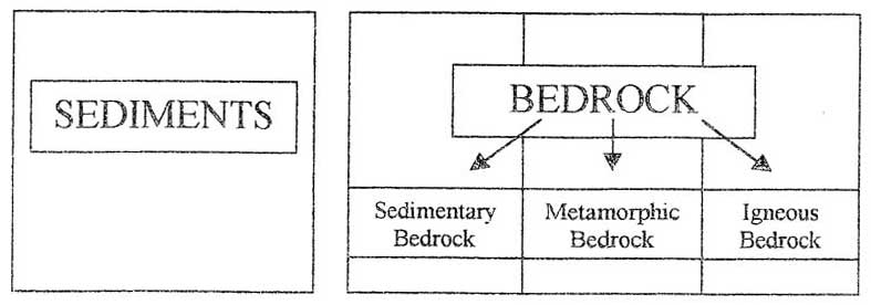
First step: recognize bedrock versus sediments.
Sediments are loose and tell the story of the present.
Bedrock is firm, coherent, continuously attached to Earth’s crust. It almost always is older than sediments. (Do not confuse sedimentary bedrock with sediments.)
All sediments came from bedrock.
Sedimentary bedrock once was sediments.
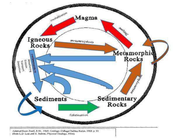
Sediments are the product of sedimentation… a set of processes that include erosion, entrainment, transport, and deposition.
Agents of sedimentation are wind, water, glacial ice, ground failure, and in our time… humans.
Sediments record the processes that deposit them… and therefore record environments of deposition.
Examples:
Little Cottonwood Creek at Snowbird records a high-energy stream in steep terrain by (1) the large size of some of its rocks, (2) poorly sorted (diverse sizes), (3) well-rounded rocks in contrast to the Jordan River that records a slow-moving stream on a valley floor by (1) the small size of its sediments (mud, sand and gravel) (2) poorly sorted (diverse sizes), and (3) well rounded gravel.
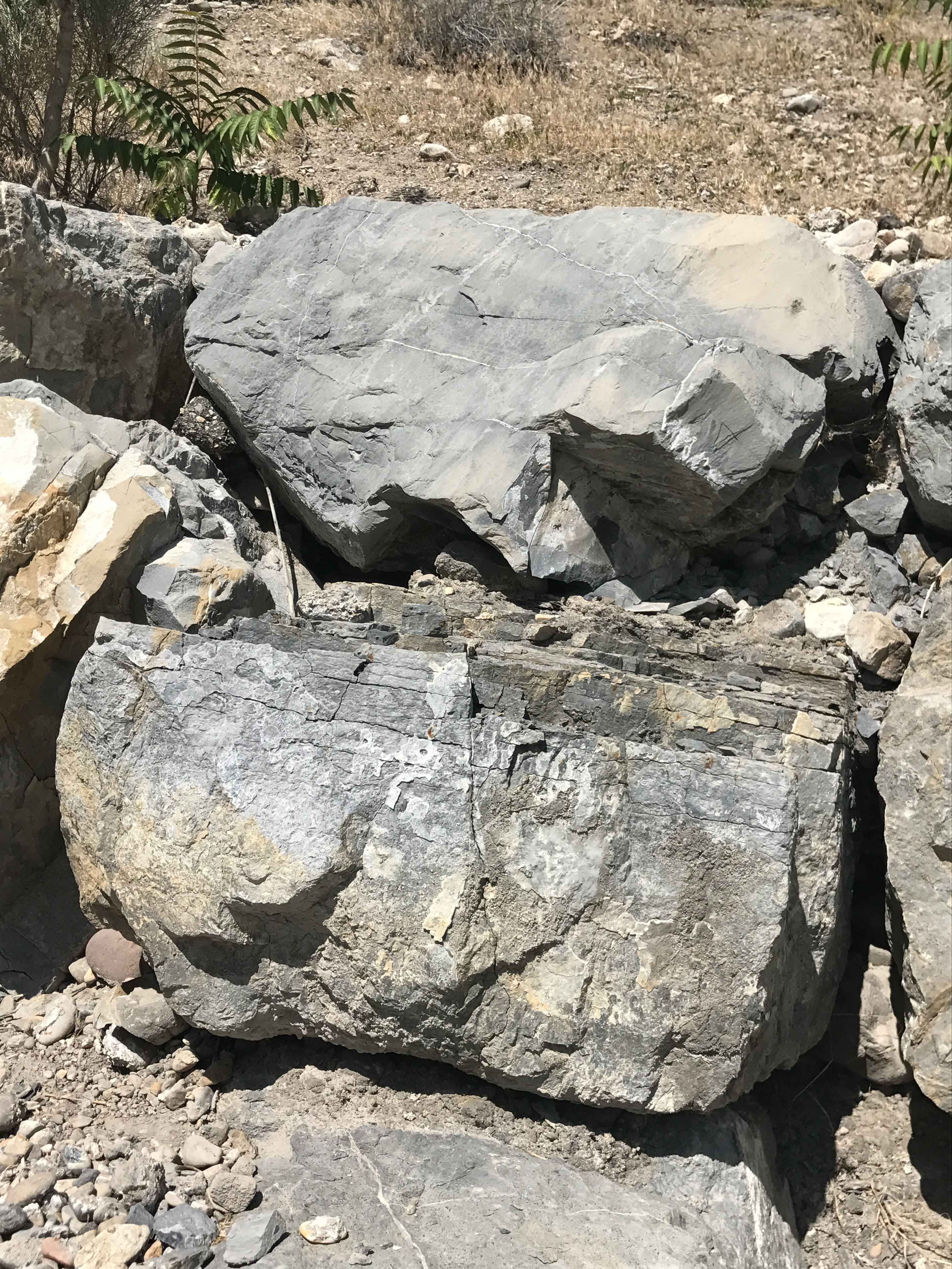
The gray boulders of the retaining wall are sediments deposited by humans. They came from sedimentary bedrock based on their fossils and layering. We can be sure that they came from a nearby quarry.
But what of those beautifully rounded cobbles (melon-sized sediments) in the pillars. Where did they come from? and how did they get there so nice and rounded? And if they came from a high energy stream… where was that stream? Was it here? And when and how?
Please… don’ t try to “answer” just wonder and look at patterns of bedrock and sediments… Earth materials that tell Utah’s geologic history.

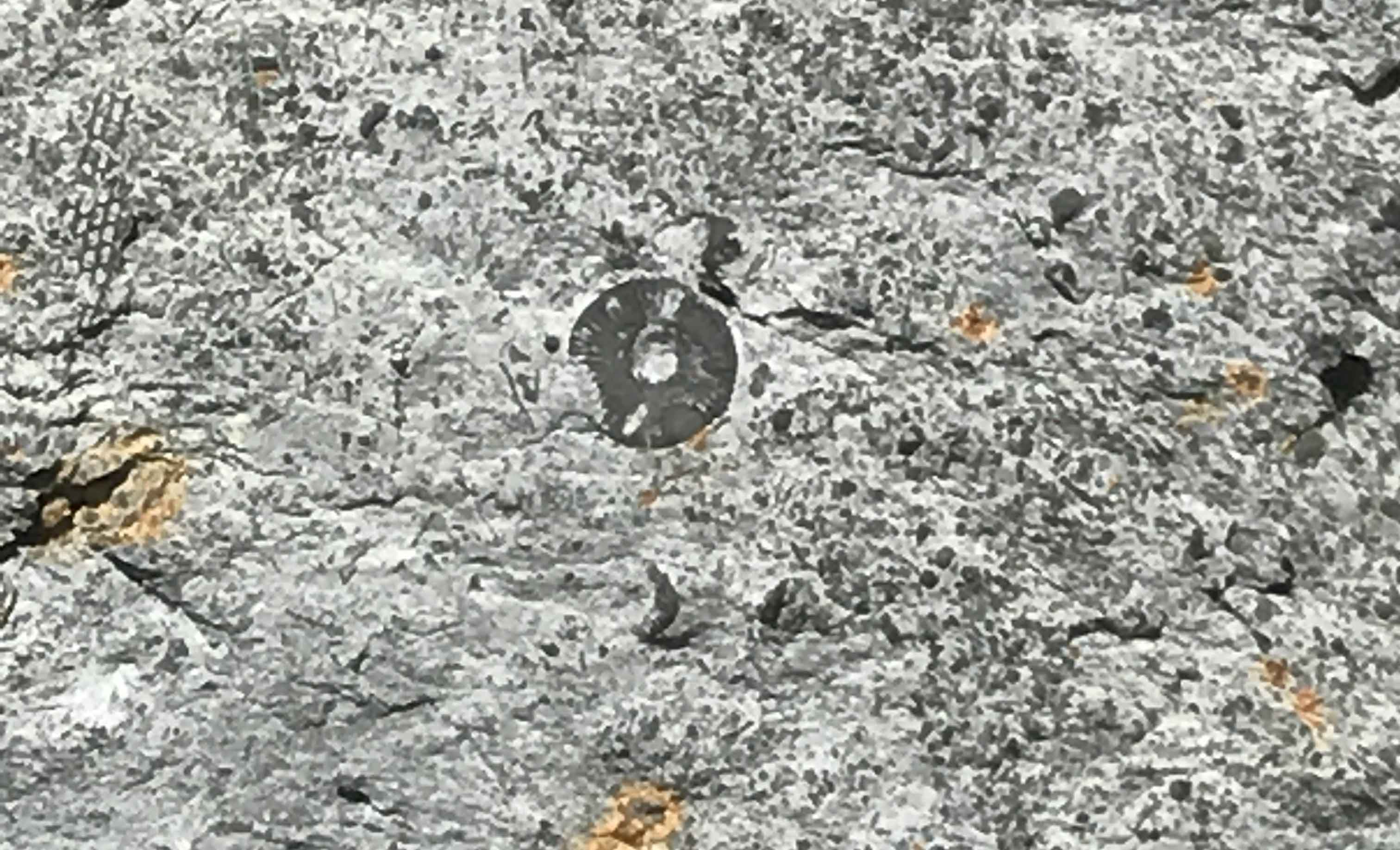
Gray bedrock of the quarry seen from the Warm Springs Loop:
The gray bedrock of the quarry is sedimentary bedrock. How can we tell? It has fossils in layers of limestone that once was sediment. Because they once were sediments we can figure out their environment of deposition. Fossils of corals and shells of organisms all buried in layers of limestone indicate that, long ago, this area of Utah was below sea level in a warm marine environment similar to today’s Bahamas.
The brown bedrock at the skyline:
It may not be obvious from Stop 3, but the brown bedrock of the skyline is sedimentary bedrock (meaning it once was sediments) with a variety of rocks including rounded, melon-sized, rocks (cobbles), as well as abundant sand and gravel. This implies that the area of the Warm Springs Loop once had fast moving, high energy streams crossing it. Where did the stream come from and where was it going?
Recognize clues to the puzzle… the puzzle being the history of this area of Utah (Salt Lake Salient, Warm Springs Fault, and Salt Lake Valley).
Which is older versus younger: the gray bedrock or the brown bedrock?
Which is older versus younger: the gray bedrock or the tilting of the gray bedrock?
Which is older versus younger: the brown bedrock or the dropping of the valley due to extensional faulting along the Wasatch Fault Zone.
Which is older versus younger: the faulting of the Wasatch Fault Zone or the tilting of the gray bedrock.
Which is older versus younger: the faulting of the Wasatch Fault Zone or the brown bedrock?
How do we “know” these relationships.
Before working it all out… Breathe!
Look around and realize how several very fine Earth scientists who care deeply about earthquake risks of Utah have stood here and wondered about the topography.
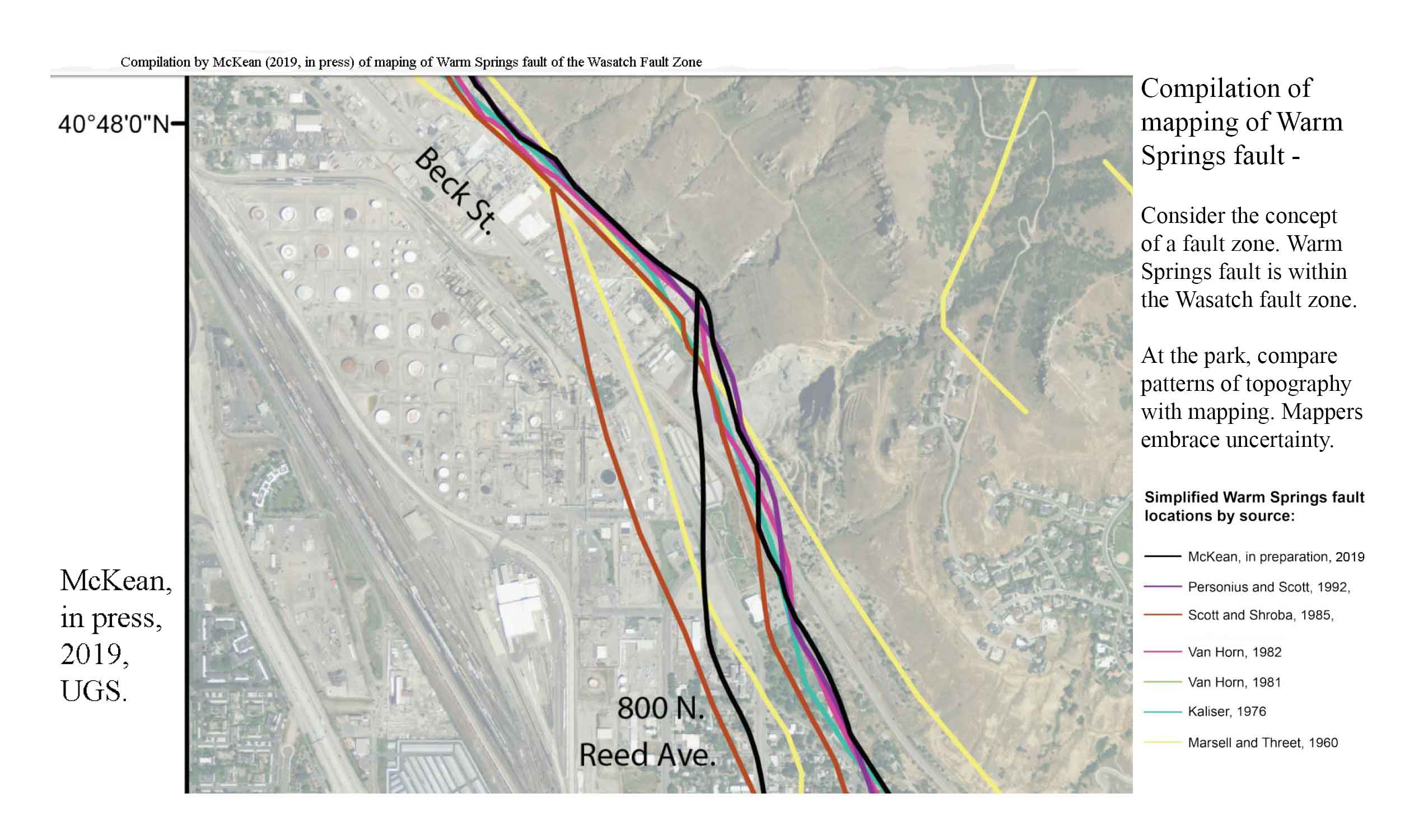
Among them are a team of Utah Geological Survey geologists who will publish a geologic map of this area in 2019. Their map will update maps by Utah’s most famous, and arguably most exceptional geologist, G.K. Gilbert of the 1870s through mappers of the 1960s, hazard mappers of the 1980s, and others. The map on the left shows their mapping of the Warm Springs Fault Zone through here. Note: some mappers drew two faults for the zone, others just one.
Tectonics rules! Today extensional tectonics drops Salt Lake Valley with respect to the Wasatch Range. Assume it or its predecessors cut both the brown bedrock and the gray bedrock. Put differently, extensional tectonics has resulted in the Wasatch Front (landform), the Salt Lake Salient (landform), Salt Lake Valley (landform).
The following chart depicts over a billion years of geologic history at this place. Please let us at Earth Science Education know if this presentation of history all on one page works for you.

RESOURCES for further inquiry:
