ESE Maps and Images for Teachers – INDEX
Click to link to download this USGS map and text.
These maps are for you!
Teachers ask ESE for maps. Maps can illustrate almost any Earth Science standard you may want to teach or may want to understand. Step 1: See patterns!
Step 2: Wonder about them.
Step 3: Figure out cause and effect, how the pattern came to be.
That’s the JOY of maps.
Please use these maps!
We want Utah teachers to have Utah examples of Earth science principles. We don’t have to go to Hawaii to study volcanoes! Utah has volcanic rocks only 700 years old. We can teach tectonics with Utah examples because we have our faults (haha). There’s no better place to teach erosion than Utah’s national parks.
Yes, use these maps, and please use them with professional courtesy, meaning, credit their source. Many are by Earth Science Education, so, credit http://www.earthscienceeducation.org. We hope you’ll recommend our site to your colleagues and students. Even more important, go outside and recognize what a map shows as patterns. Maps are guideposts to the real world. We hope you feel genuine JOY when a pattern clicks with a process.
LIST of maps and images and LINKS to content
There is no logical order to this list. We add maps and images as we create them.
Click on the image to link to its webpage. There you can download a jpg file and may find more information such as text, audio, or even ties to STEM standards. We appreciate helpful feedback! CLICK to read ESE Terms of Use for our maps and other resources (not active 4/2021)
ESE TeachMap # 0001 – Utah’s Land Surface
Patterns on this map show terrain steepness and, as a result, show Utah’s landforms. This is a great map to use to teach “models.” USGS scientists created this map using math. It’s not a satellite image. It’s not aerial photography. The scientists had detailed elevation data, calculated steepness, and made it into this map using GIS (geographic information science).
This also is a good map to use as the base for other maps. It shows landforms by showing steepness. Utah’s regions have been defined on the basis of landforms. (See ESE TeachMap – 0002). Landforms look the way they do because of their geologic history. Patterns to see on this map are the “caterpillars heading north” looking ranges of western Utah.
Click on the map to go to the map’s page with more information.
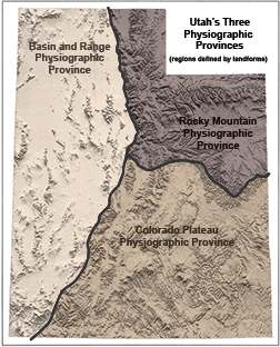
ESE TeachMap # 0002 – Utah’s Three Physiographic Provinces
Physiographic regions are regions based on geology such as landforms and rock types.
The 3 colored areas on this map show Utah’s regions defined by contrasting terrain. Big Concept- today’s terrain is the cumulative effect of tectonics and erosion, meaning Utah’s past history into the present. To the west, the terrain is characterized by mostly gray mountain ranges separated by broad basins with loose sediment. To the northeast is terrain similar to the Rocky Mountain region of Colorado and Wyoming. To the southeast is Utah’s big, bold, red, layered-bedrock terrain cut by tributaries of the Colorado River.
Click on the map for a higher resolution jpg and for additional information. Click here for more about regions.
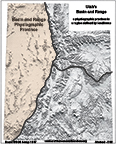
ESE TeachMap # 0003 – Utah’s Basin and Range province
Western Utah looks different from eastern Utah because it is different! The region, over time, has experienced a somewhat different tectonic history (meaning processes that change the structure of portions of Earth’s crust) and different erosional history (meaning the “taking away” of rock by wind, water, glacial ice, ground failure and biologic factors). Today, tectonic forces are active, making Utah extend slightly wider. Satellite GPS can actually measure how Wendover moves slightly farther west than Park City. Agents of erosion, such as water and wind, attack the resulting high places (ranges) and deposit thousands of feet of sediments in the low places (basins). There are dozens of basins and ranges in Utah’s Basin and Range province.
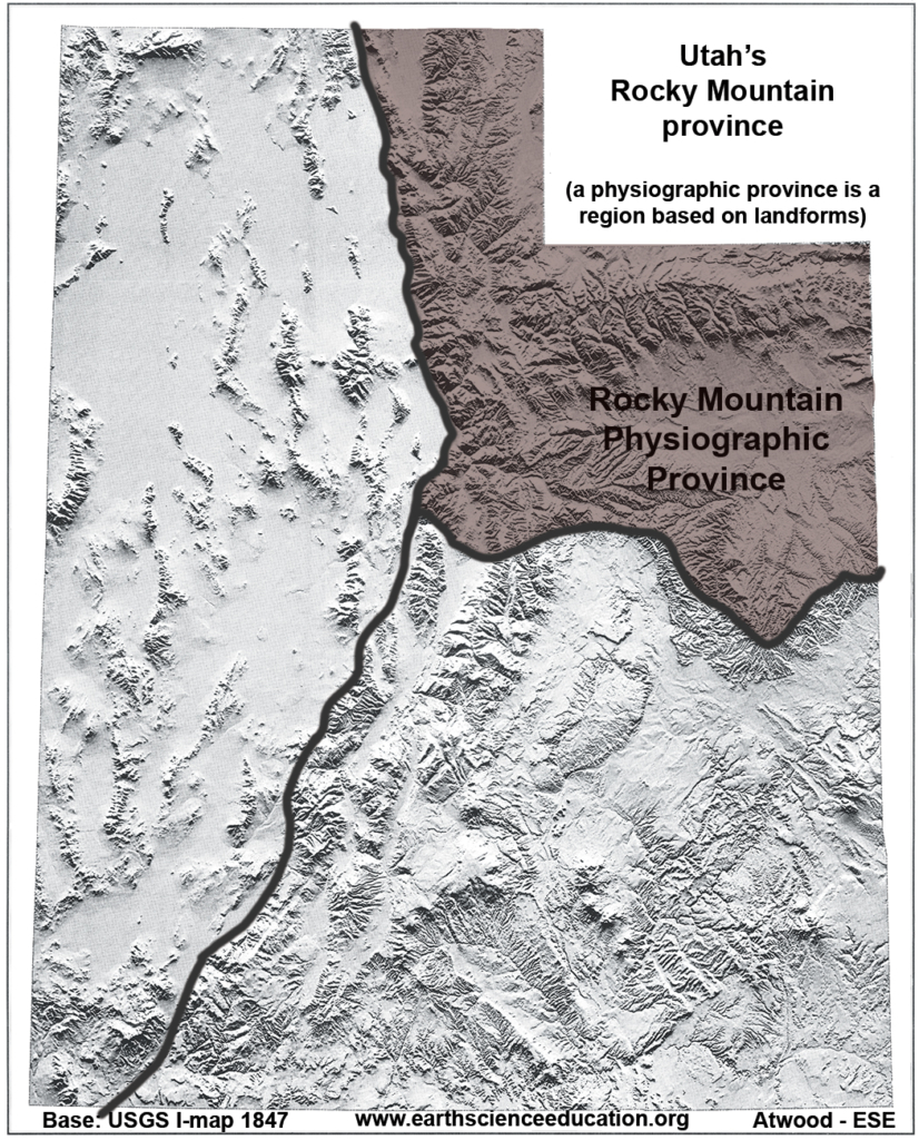
ESE TeachMap # 0004 – Utah’s Rocky Mountain province
Northeastern Utah’s Rocky Mountain region is characterized by purple mountain majesty such as the Uinta Mountains and the Wasatch Range. These bold mountains are underpinned by very old, resistant bedrock. However, Utah’s Rocky Mountain province also includes the tan-gray parched terrain of the Uinta Basin. Erosion and deposition work on the region’s surface. Erosion wins, but not as dramatically as in the Colorado Plateau. Today the region is tectonically stable except at its western boundary, the Wasatch fault zone. Utah’s two major rivers, the Colorado River and the Bear River flow from the region via two watersheds to different destinations.